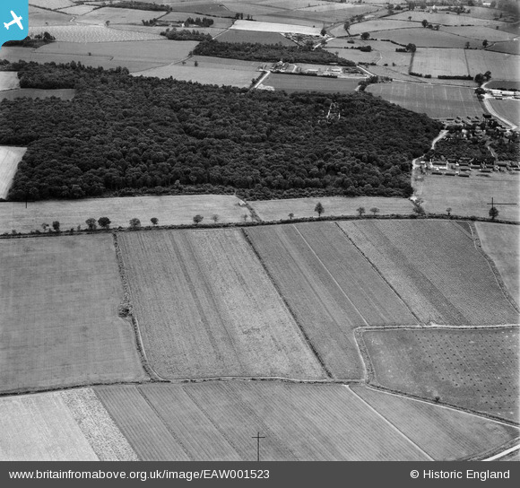
EAW001523 ENGLAND (1946). Fields either side of Pantlings Lane near Upney Wood, Kelvedon, 1946
© Copyright OpenStreetMap contributors and licensed by the OpenStreetMap Foundation. 2025. Cartography is licensed as CC BY-SA.
Nearby Images (6)
Details
| Title | [EAW001523] Fields either side of Pantlings Lane near Upney Wood, Kelvedon, 1946 |
| Reference | EAW001523 |
| Date | 5-July-1946 |
| Link | |
| Place name | KELVEDON |
| Parish | KELVEDON |
| District | |
| Country | ENGLAND |
| Easting / Northing | 583669, 220580 |
| Longitude / Latitude | 0.66718339768711, 51.85310196002 |
| National Grid Reference | TL837206 |
Pins

Matt Aldred edob.mattaldred.com |
Friday 14th of October 2022 02:09:49 PM | |

Matt Aldred edob.mattaldred.com |
Tuesday 9th of June 2020 10:26:38 PM | |

Matt Aldred edob.mattaldred.com |
Tuesday 9th of June 2020 10:26:15 PM | |

Matt Aldred edob.mattaldred.com |
Tuesday 9th of June 2020 10:25:16 PM | |

Matt Aldred edob.mattaldred.com |
Tuesday 9th of June 2020 10:24:24 PM | |

Matt Aldred edob.mattaldred.com |
Tuesday 9th of June 2020 06:02:32 PM | |

Matt Aldred edob.mattaldred.com |
Tuesday 9th of June 2020 05:56:22 PM | |

Matt Aldred edob.mattaldred.com |
Tuesday 9th of June 2020 05:56:04 PM | |

Matt Aldred edob.mattaldred.com |
Tuesday 9th of June 2020 05:55:49 PM | |

Matt Aldred edob.mattaldred.com |
Tuesday 9th of June 2020 05:48:21 PM | |

Matt Aldred edob.mattaldred.com |
Tuesday 9th of June 2020 05:48:08 PM |


![[EAW001523] Fields either side of Pantlings Lane near Upney Wood, Kelvedon, 1946](http://britainfromabove.org.uk/sites/all/libraries/aerofilms-images/public/100x100/EAW/001/EAW001523.jpg)
![[EAW001522] Fields either side of Pantlings Lane near Upney Wood, Kelvedon, 1946](http://britainfromabove.org.uk/sites/all/libraries/aerofilms-images/public/100x100/EAW/001/EAW001522.jpg)
![[EAW001521] Fields either side of Pantlings Lane near Upney Wood, Kelvedon, 1946](http://britainfromabove.org.uk/sites/all/libraries/aerofilms-images/public/100x100/EAW/001/EAW001521.jpg)
![[EAW001520] Fields either side of Pantlings Lane near Upney Wood, Kelvedon, 1946](http://britainfromabove.org.uk/sites/all/libraries/aerofilms-images/public/100x100/EAW/001/EAW001520.jpg)
![[EAW001518] Fields either side of Pantlings Lane near Upney Wood, Kelvedon, 1946](http://britainfromabove.org.uk/sites/all/libraries/aerofilms-images/public/100x100/EAW/001/EAW001518.jpg)
![[EAW001519] Fields either side of Pantlings Lane near Upney Wood, Kelvedon, 1946](http://britainfromabove.org.uk/sites/all/libraries/aerofilms-images/public/100x100/EAW/001/EAW001519.jpg)