
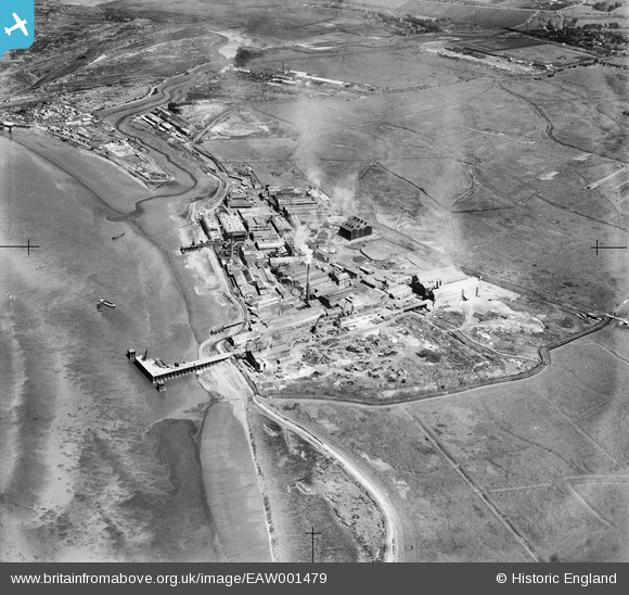
EAW001479 ENGLAND (1946). Factories at Rainham Ferry, Rainham, 1946
© Copyright OpenStreetMap contributors and licensed by the OpenStreetMap Foundation. 2026. Cartography is licensed as CC BY-SA.
Nearby Images (8)
EAW001479

EAW001481

EAW001480

EAW001475

EAW001482

EAW001476

EAW001477

EAW001478

Details
| Title | [EAW001479] Factories at Rainham Ferry, Rainham, 1946 |
| Reference | EAW001479 |
| Date | 3-July-1946 |
| Link | |
| Place name | RAINHAM |
| Parish | |
| District | |
| Country | ENGLAND |
| Easting / Northing | 551501, 180472 |
| Longitude / Latitude | 0.18305188013566, 51.50236646532 |
| National Grid Reference | TQ515805 |
Pins

Matt Aldred edob.mattaldred.com |
Saturday 20th of February 2021 02:39:02 PM | |
|
Matt Aldred edob.mattaldred.com |
Saturday 20th of February 2021 02:38:53 PM | |
|
Matt Aldred edob.mattaldred.com |
Saturday 20th of February 2021 02:38:44 PM |