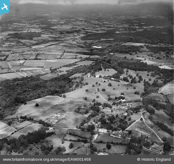
EAW001468 ENGLAND (1946). The village and surrounding countryside, Frant, from the south-west, 1946
© Copyright OpenStreetMap contributors and licensed by the OpenStreetMap Foundation. 2026. Cartography is licensed as CC BY-SA.
Nearby Images (11)
Details
| Title | [EAW001468] The village and surrounding countryside, Frant, from the south-west, 1946 |
| Reference | EAW001468 |
| Date | 3-July-1946 |
| Link | |
| Place name | FRANT |
| Parish | FRANT |
| District | |
| Country | ENGLAND |
| Easting / Northing | 559003, 135716 |
| Longitude / Latitude | 0.27111816806657, 51.098142360332 |
| National Grid Reference | TQ590357 |


![[EAW001468] The village and surrounding countryside, Frant, from the south-west, 1946](http://britainfromabove.org.uk/sites/all/libraries/aerofilms-images/public/100x100/EAW/001/EAW001468.jpg)
![[EAW001467] The village and surrounding countryside, Frant, from the south-west, 1946](http://britainfromabove.org.uk/sites/all/libraries/aerofilms-images/public/100x100/EAW/001/EAW001467.jpg)
![[EPW028554] St Alban's Church and environs, Frant, 1929](http://britainfromabove.org.uk/sites/all/libraries/aerofilms-images/public/100x100/EPW/028/EPW028554.jpg)
![[EPW028549] St Alban's Church and the village centre, Frant, 1929](http://britainfromabove.org.uk/sites/all/libraries/aerofilms-images/public/100x100/EPW/028/EPW028549.jpg)
![[EAW003546] Fields between the village and Chase Wood, Frant, from the south-west, 1947](http://britainfromabove.org.uk/sites/all/libraries/aerofilms-images/public/100x100/EAW/003/EAW003546.jpg)
![[EAW002294] Countryside between the village, Chase Wood and Ely Grange, Frant, from the west, 1946](http://britainfromabove.org.uk/sites/all/libraries/aerofilms-images/public/100x100/EAW/002/EAW002294.jpg)
![[EAW002295] Countryside between the village, Chase Wood and Ely Grange, Frant, from the west, 1946](http://britainfromabove.org.uk/sites/all/libraries/aerofilms-images/public/100x100/EAW/002/EAW002295.jpg)
![[EPW028553] St Alban's Church, Victoria Well and the village centre, Frant, 1929](http://britainfromabove.org.uk/sites/all/libraries/aerofilms-images/public/100x100/EPW/028/EPW028553.jpg)
![[EPW050336] Ely Grange, Frant, from the west, 1936](http://britainfromabove.org.uk/sites/all/libraries/aerofilms-images/public/100x100/EPW/050/EPW050336.jpg)
![[EAW003099] Chase Wood and Oxpasture Wood, Frant, from the south-west, 1946](http://britainfromabove.org.uk/sites/all/libraries/aerofilms-images/public/100x100/EAW/003/EAW003099.jpg)
![[EAW003545] Fields between the village and Chase Wood, Frant, 1947](http://britainfromabove.org.uk/sites/all/libraries/aerofilms-images/public/100x100/EAW/003/EAW003545.jpg)
