
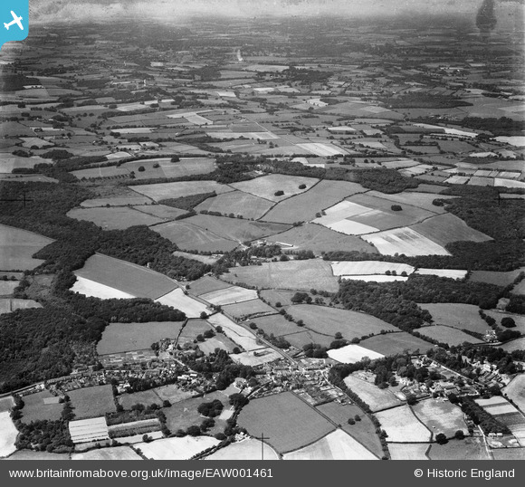
EAW001461 ENGLAND (1946). East Hoathly and countryside around Old Whyly, East Hoathly, from the south-east, 1946
© Copyright OpenStreetMap contributors and licensed by the OpenStreetMap Foundation. 2024. Cartography is licensed as CC BY-SA.
Nearby Images (2)
EAW001461

EAW001463

Details
| Title | [EAW001461] East Hoathly and countryside around Old Whyly, East Hoathly, from the south-east, 1946 |
| Reference | EAW001461 |
| Date | 3-July-1946 |
| Link | |
| Place name | EAST HOATHLY |
| Parish | EAST HOATHLY WITH HALLAND |
| District | |
| Country | ENGLAND |
| Easting / Northing | 552074, 116388 |
| Longitude / Latitude | 0.16412259931945, 50.926325192275 |
| National Grid Reference | TQ521164 |
Pins
Be the first to add a comment to this image!