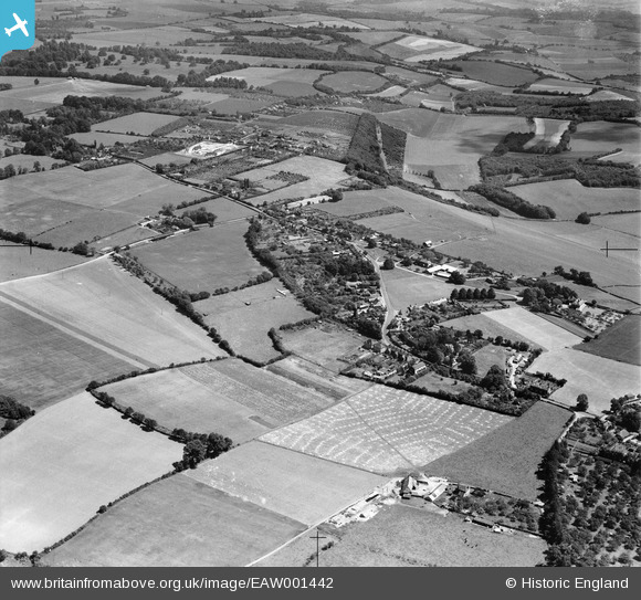
EAW001442 ENGLAND (1946). The village, Meopham Green, from the south-west, 1946
© Copyright OpenStreetMap contributors and licensed by the OpenStreetMap Foundation. 2025. Cartography is licensed as CC BY-SA.
Details
| Title | [EAW001442] The village, Meopham Green, from the south-west, 1946 |
| Reference | EAW001442 |
| Date | 3-July-1946 |
| Link | |
| Place name | MEOPHAM GREEN |
| Parish | MEOPHAM |
| District | |
| Country | ENGLAND |
| Easting / Northing | 563687, 165024 |
| Longitude / Latitude | 0.35135251637455, 51.360167945498 |
| National Grid Reference | TQ637650 |
Pins
 MB |
Saturday 14th of September 2013 02:32:00 PM | |
 MB |
Saturday 14th of September 2013 02:31:36 PM | |
 MB |
Saturday 14th of September 2013 02:27:02 PM |


![[EAW001442] The village, Meopham Green, from the south-west, 1946](http://britainfromabove.org.uk/sites/all/libraries/aerofilms-images/public/100x100/EAW/001/EAW001442.jpg)
![[EAW001443] The village, Meopham Green, from the south-west, 1946](http://britainfromabove.org.uk/sites/all/libraries/aerofilms-images/public/100x100/EAW/001/EAW001443.jpg)