
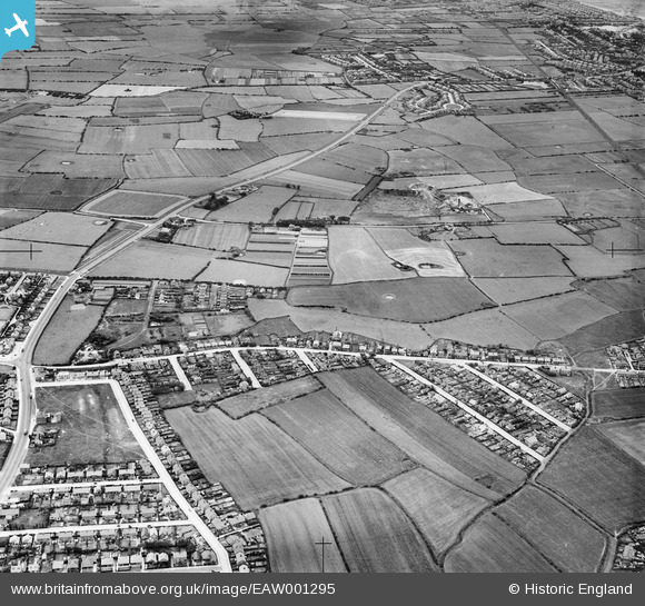
EAW001295 ENGLAND (1946). Housing off Bermuda Road, Hoylake Road and the surrounding countryside, Hoylake, 1946
© Copyright OpenStreetMap contributors and licensed by the OpenStreetMap Foundation. 2025. Cartography is licensed as CC BY-SA.
Nearby Images (2)
EAW001295

EAW001606

Details
| Title | [EAW001295] Housing off Bermuda Road, Hoylake Road and the surrounding countryside, Hoylake, 1946 |
| Reference | EAW001295 |
| Date | 24-June-1946 |
| Link | |
| Place name | HOYLAKE |
| Parish | |
| District | |
| Country | ENGLAND |
| Easting / Northing | 325056, 389756 |
| Longitude / Latitude | -3.1272767816903, 53.39904218857 |
| National Grid Reference | SJ251898 |
Pins
 Sparky |
Friday 17th of November 2017 06:52:31 PM | |
Babs McGinlay |
Friday 11th of April 2014 12:00:58 AM | |
AlexWilko |
Saturday 8th of February 2014 01:05:48 PM | |
AlexWilko |
Saturday 8th of February 2014 01:04:56 PM | |
AlexWilko |
Saturday 8th of February 2014 01:01:19 PM | |
AlexWilko |
Saturday 8th of February 2014 12:59:35 PM |