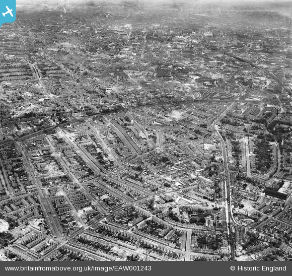
EAW001243 ENGLAND (1946). A cityscape over Balsall Heath and Highgate including Stratford Road, Balsall Heath, from the south-east, 1946
    © Copyright OpenStreetMap contributors and licensed by the OpenStreetMap Foundation. 2025. Cartography is licensed as CC BY-SA.
  
Details
| Title | [EAW001243] A cityscape over Balsall Heath and Highgate including Stratford Road, Balsall Heath, from the south-east, 1946 | 
| Reference | EAW001243 | 
| Date | 24-July-1946 | 
| Link | |
| Place name | BALSALL HEATH | 
| Parish | |
| District | |
| Country | ENGLAND | 
| Easting / Northing | 408684, 284319 | 
| Longitude / Latitude | -1.8721882599658, 52.456381367792 | 
| National Grid Reference | SP087843 | 
 
             
  ![[EAW001243] A cityscape over Balsall Heath and Highgate including Stratford Road, Balsall Heath, from the south-east, 1946](http://britainfromabove.org.uk/sites/all/libraries/aerofilms-images/public/100x100/EAW/001/EAW001243.jpg) 
  
                                          ![[EAW001242] A cityscape over Balsall Heath and Highgate, Balsall Heath, from the south-east, 1946](http://britainfromabove.org.uk/sites/all/libraries/aerofilms-images/public/100x100/EAW/001/EAW001242.jpg) 
 ![[EAW001244] A cityscape over Balsall Heath and Sparkbrook including Stratford Road, Balsall Heath, from the south-east, 1946](http://britainfromabove.org.uk/sites/all/libraries/aerofilms-images/public/100x100/EAW/001/EAW001244.jpg) 
  Kensington Gardens ?
 Kensington Gardens ?