
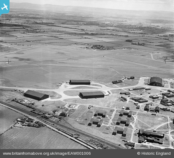
EAW001006 ENGLAND (1946). RAF Middleton St George Airfield, Middleton St George, from the north-west, 1946
© Copyright OpenStreetMap contributors and licensed by the OpenStreetMap Foundation. 2026. Cartography is licensed as CC BY-SA.
Nearby Images (2)
EAW001006

EAW001007

Details
| Title | [EAW001006] RAF Middleton St George Airfield, Middleton St George, from the north-west, 1946 |
| Reference | EAW001006 |
| Date | 6-June-1946 |
| Link | |
| Place name | MIDDLETON ST GEORGE |
| Parish | MIDDLETON ST. GEORGE |
| District | |
| Country | ENGLAND |
| Easting / Northing | 436922, 513735 |
| Longitude / Latitude | -1.4295766021626, 54.517436499421 |
| National Grid Reference | NZ369137 |
Pins

redmist |
Tuesday 16th of November 2021 02:04:51 PM | |
|
redmist |
Tuesday 16th of November 2021 01:38:47 PM | |
|
redmist |
Tuesday 16th of November 2021 01:38:09 PM | |
|
redmist |
Tuesday 16th of November 2021 01:37:20 PM | |
|
redmist |
Tuesday 16th of November 2021 01:36:54 PM | |
|
J May |
Thursday 4th of March 2021 03:06:37 PM | |
|
Stubzi34 |
Saturday 1st of March 2014 12:46:54 PM | |
|
Graeme |
Saturday 21st of December 2013 04:19:16 AM | |
|
Graeme |
Saturday 21st of December 2013 04:02:42 AM | |
|
Graeme |
Saturday 21st of December 2013 04:01:49 AM |