
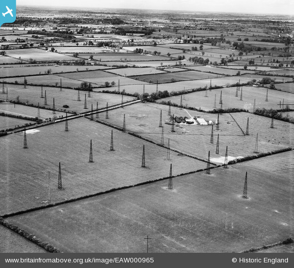
EAW000965 ENGLAND (1946). Radio masts at RAF Stoke Hammond, Stoke Hammond, from the south, 1946
© Copyright OpenStreetMap contributors and licensed by the OpenStreetMap Foundation. 2026. Cartography is licensed as CC BY-SA.
Nearby Images (2)
EAW000965

EAW000963

Details
| Title | [EAW000965] Radio masts at RAF Stoke Hammond, Stoke Hammond, from the south, 1946 |
| Reference | EAW000965 |
| Date | 28-May-1946 |
| Link | |
| Place name | STOKE HAMMOND |
| Parish | DRAYTON PARSLOW |
| District | |
| Country | ENGLAND |
| Easting / Northing | 486707, 228725 |
| Longitude / Latitude | -0.73824465972414, 51.949820472593 |
| National Grid Reference | SP867287 |
Pins

Matt Aldred edob.mattaldred.com |
Sunday 10th of March 2024 12:23:02 PM |