
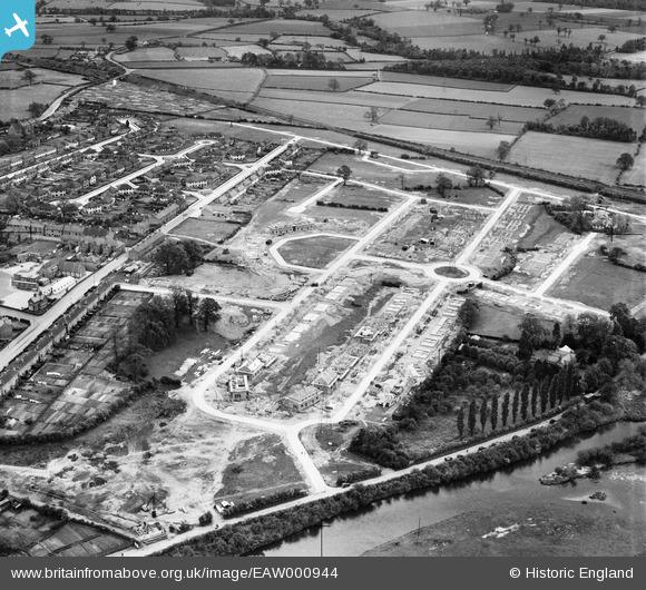
EAW000944 ENGLAND (1946). New housing under construction along Norfolk and Suffolk Roads, Stapenhill, 1946
© Copyright OpenStreetMap contributors and licensed by the OpenStreetMap Foundation. 2025. Cartography is licensed as CC BY-SA.
Nearby Images (2)
EAW000944

EAW044108

Details
| Title | [EAW000944] New housing under construction along Norfolk and Suffolk Roads, Stapenhill, 1946 |
| Reference | EAW000944 |
| Date | 29-May-1946 |
| Link | |
| Place name | STAPENHILL |
| Parish | STAPENHILL |
| District | |
| Country | ENGLAND |
| Easting / Northing | 424914, 320992 |
| Longitude / Latitude | -1.6305519454195, 52.785594642791 |
| National Grid Reference | SK249210 |
Pins
Be the first to add a comment to this image!