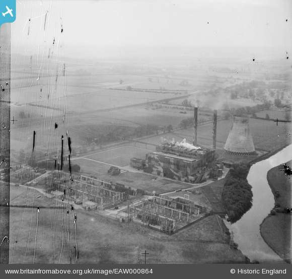
EAW000864 ENGLAND (1946). Little Barford Power Station, Little Barford, 1946. This image has been produced from a damaged negative.
© Copyright OpenStreetMap contributors and licensed by the OpenStreetMap Foundation. 2026. Cartography is licensed as CC BY-SA.
Nearby Images (11)
Details
| Title | [EAW000864] Little Barford Power Station, Little Barford, 1946. This image has been produced from a damaged negative. |
| Reference | EAW000864 |
| Date | 15-May-1946 |
| Link | |
| Place name | LITTLE BARFORD |
| Parish | LITTLE BARFORD |
| District | |
| Country | ENGLAND |
| Easting / Northing | 518415, 257690 |
| Longitude / Latitude | -0.26697344152936, 52.204297311616 |
| National Grid Reference | TL184577 |
Pins

redmist |
Thursday 11th of November 2021 10:19:08 PM | |

redmist |
Thursday 11th of November 2021 10:18:50 PM | |

redmist |
Thursday 11th of November 2021 09:43:29 PM | |

Sparky |
Friday 28th of July 2017 07:28:25 AM | |

melgibbs |
Wednesday 22nd of January 2014 09:21:08 AM | |

melgibbs |
Tuesday 21st of January 2014 08:35:08 PM |


![[EAW000864] Little Barford Power Station, Little Barford, 1946. This image has been produced from a damaged negative.](http://britainfromabove.org.uk/sites/all/libraries/aerofilms-images/public/100x100/EAW/000/EAW000864.jpg)
![[EAW000872] Little Barford Power Station and environs, Little Barford, from the east, 1946](http://britainfromabove.org.uk/sites/all/libraries/aerofilms-images/public/100x100/EAW/000/EAW000872.jpg)
![[EAW003725] The River Great Ouse in flood opposite the Little Barford Electric Power Station, Little Barford, from the north-east, 1947](http://britainfromabove.org.uk/sites/all/libraries/aerofilms-images/public/100x100/EAW/003/EAW003725.jpg)
![[EAW000874] Little Barford Power Station and environs, Little Barford, from the south-east, 1946](http://britainfromabove.org.uk/sites/all/libraries/aerofilms-images/public/100x100/EAW/000/EAW000874.jpg)
![[EAW000879] Little Barford Power Station, Little Barford, 1946](http://britainfromabove.org.uk/sites/all/libraries/aerofilms-images/public/100x100/EAW/000/EAW000879.jpg)
![[EAW000876] Little Barford Power Station, Little Barford, 1946](http://britainfromabove.org.uk/sites/all/libraries/aerofilms-images/public/100x100/EAW/000/EAW000876.jpg)
![[EAW000877] Little Barford Power Station and environs, Little Barford, 1946](http://britainfromabove.org.uk/sites/all/libraries/aerofilms-images/public/100x100/EAW/000/EAW000877.jpg)
![[EAW000865] Little Barford Power Station, Little Barford, from the north, 1946. This image has been produced from a damaged negative.](http://britainfromabove.org.uk/sites/all/libraries/aerofilms-images/public/100x100/EAW/000/EAW000865.jpg)
![[EAW000875] Little Barford Power Station and environs, Little Barford, from the south-east, 1946](http://britainfromabove.org.uk/sites/all/libraries/aerofilms-images/public/100x100/EAW/000/EAW000875.jpg)
![[EAW000866] Little Barford Power Station, Little Barford, from the north-east, 1946. This image has been produced from a damaged negative.](http://britainfromabove.org.uk/sites/all/libraries/aerofilms-images/public/100x100/EAW/000/EAW000866.jpg)
![[EAW000873] Little Barford Power Station and environs, Little Barford, from the north, 1946](http://britainfromabove.org.uk/sites/all/libraries/aerofilms-images/public/100x100/EAW/000/EAW000873.jpg)