
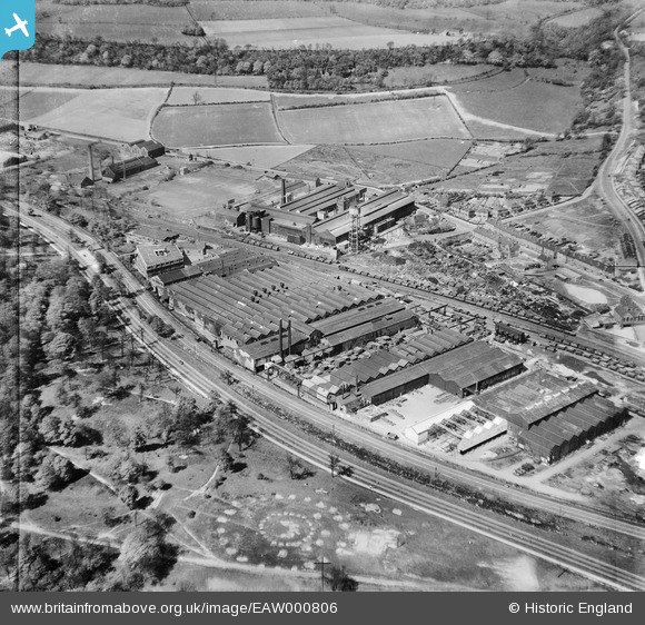
EAW000806 ENGLAND (1946). Arthur Lee and Sons Ltd Trubrite Works, Wincobank, 1946
© Copyright OpenStreetMap contributors and licensed by the OpenStreetMap Foundation. 2026. Cartography is licensed as CC BY-SA.
Nearby Images (21)
EAW000806

EPW046731

EAW000808

EPW060701

EPW005959

EPW060699

EPW005957

EPW046732

EPW046734

EAW000810

EPW046728

EPW046730

EPW046729

EPW005958

EPW061449

EPW046733

EAW000809

EPW060697

EAW000807

EAW000805

EPW060700

Details
| Title | [EAW000806] Arthur Lee and Sons Ltd Trubrite Works, Wincobank, 1946 |
| Reference | EAW000806 |
| Date | 12-May-1946 |
| Link | |
| Place name | WINCOBANK |
| Parish | |
| District | |
| Country | ENGLAND |
| Easting / Northing | 438587, 392454 |
| Longitude / Latitude | -1.4192146200515, 53.427205119981 |
| National Grid Reference | SK386925 |

