EAW000792 ENGLAND (1946). RAF Ringway, Castle Hill, 1946
© Copyright OpenStreetMap contributors and licensed by the OpenStreetMap Foundation. 2024. Cartography is licensed as CC BY-SA.
Nearby Images (5)
Details
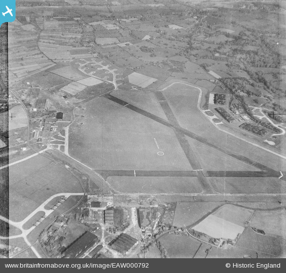
Title | [EAW000792] RAF Ringway, Castle Hill, 1946 |
Reference | EAW000792 |
Date | 12-May-1946 |
Link | |
Place name | CASTLE HILL |
Parish | RINGWAY |
District | |
Country | ENGLAND |
Easting / Northing | 381874, 384256 |
Longitude / Latitude | -2.272355425229, 53.354609388363 |
National Grid Reference | SJ819843 |
Pins
Outwood Lane |
John Ellis |
Monday 12th of January 2015 05:52:55 PM |
Altrincham Road - towards Oversleyford and the A538 Altrincham-Wilmslow Road. |
John Ellis |
Monday 12th of January 2015 05:37:23 PM |
Ringway Road, with Heyhead hamlet to the north and left. |
John Ellis |
Sunday 11th of January 2015 05:55:58 PM |
Yew Tree Lane, Ringway |
John Ellis |
Sunday 11th of January 2015 05:54:50 PM |
Styal Cross |
John Ellis |
Sunday 11th of January 2015 05:52:12 PM |
Wilkins Lane, Styal |
John Ellis |
Sunday 11th of January 2015 05:50:36 PM |
Styal village centre |
John Ellis |
Sunday 11th of January 2015 05:48:07 PM |
Holly Lane |
John Ellis |
Sunday 11th of January 2015 05:23:03 PM |
Moss Lane |
John Ellis |
Sunday 11th of January 2015 05:22:08 PM |
Altrincham Road |
John Ellis |
Sunday 11th of January 2015 05:18:43 PM |
Smoke wind indicator |
IanL |
Sunday 25th of May 2014 10:33:30 PM |
Signal square - indicates that Runway 10 or 06 (crosswind) were likely to be in use (T indicates the landing direction with pilots landing towards the top of the T)and that pilots must confine aircraft movements to paved surfaces (dumbell) |
IanL |
Sunday 25th of May 2014 10:32:14 PM |
Hangar No1 - attached to the 1938 terminal building. |
IanL |
Thursday 15th of May 2014 06:01:54 PM |
Hale Road |
IanL |
Thursday 15th of May 2014 05:54:24 PM |
Fairey Aviation Hangar complex - was used from 1936 till 1977 by the company. At the time of this photograph the facility was being used for the conversion of Handley Page Halifax bombers into freight and paratroop transports. Just to the North you can see a number of aircraft on the dispersal and a further two Halifax bombers parked outside the large hangar. A further four aircraft are immediately behind the central Fairey hangar. |
IanL |
Thursday 15th of May 2014 05:53:12 PM |
Hangar No3 - 1939 Bellman hangar used by the Parachute Training School during WWII |
IanL |
Thursday 15th of May 2014 05:51:46 PM |
Hangar No2 - 1939 Bellman hangar used by the Air Transport Auxillary |
IanL |
Thursday 15th of May 2014 05:50:30 PM |
Additional hangar erected during WWII for the use of the Parachute Training School |
IanL |
Thursday 15th of May 2014 05:49:22 PM |
Hangar No7 (formerly No5 during wartime when used by Parachute Training School) - remained in use until the construction of Terminal 3 in 1996. |
IanL |
Thursday 15th of May 2014 05:45:52 PM |
Hangar No6 (formerly No4 during wartime when used by Parachute Training School) - remained in use until the construction of Terminal 3 in 1996. |
IanL |
Thursday 15th of May 2014 05:45:09 PM |
Airport apron |
IanL |
Thursday 15th of May 2014 05:39:30 PM |
The 1938 airport terminal building remained in use until 1949 when buildings behind Hangar 6 were converted to create a new passenger facility. |
IanL |
Thursday 15th of May 2014 05:29:46 PM |
East dispersal area, some of which remains to this day. The area used to have the airfield radar array. This has now been relocated. The airfield Fire & Rescue service have a dedicated training facility on this area now.
|
IanL |
Thursday 15th of May 2014 05:25:47 PM |
Moss Lane |
IanL |
Thursday 15th of May 2014 05:23:08 PM |
Runway 02/20 - the displaced thresholds gave about 3000ft of available runway for operations. This runway remained in use till the late 1970s for light aircraft. With the expansion of the airport and the creation of Terminal 2 the runway was taken out of use and what remains forms parts of Taxiway A and C and a light aircraft parking area |
IanL |
Thursday 15th of May 2014 05:10:03 PM |
Runway 10/28 - with displaced thresholds this provided about 3000ft for operations. The runway remained in use for light aircraft up to the late 1970s. It is now disused with sections remaining in use as taxiway and light aircraft parking |
IanL |
Thursday 15th of May 2014 05:09:23 PM |
Runway 24/06 - 4,200ft long at this time. Still in use today, albeit significantly longer to 3048m (10,000ft) x 45m (147ft) wide. Due to magnetic variation the runway designation is now 23R/05L |
IanL |
Thursday 15th of May 2014 05:07:26 PM |
Taxiway to South dispersal area crosses Altrincham Road. |
IanL |
Thursday 15th of May 2014 05:05:15 PM |
South Dispersal area built for the use of Avro to support Lancaster production but apparently not used by them. Used temporary storage of surplus aircraft prior to dismantling. The area is believed to have been returned to farmland about 1949. |
IanL |
Thursday 15th of May 2014 05:03:44 PM |
Avro Hangar No 523 - used for the assembly of Lancaster and Manchester Bombers together with York transports during WWII. Demolished to make way for the second runway. |
IanL |
Thursday 15th of May 2014 04:58:21 PM |
AVRO hangars used for the final assembly of Lancaster& Manchester Bombers together with Avro York Transports during WWII. This is Hangar No 522. Following the war this hangar was used to house increasing numbers of private & executive aircraft. Remained in use until demolition to make way for the second main runway (24L/06R). |
IanL |
Thursday 15th of May 2014 04:57:28 PM |
Avro Hangar No 521 - used for the assembly of Lancaster and Manchester Bombers together with York transports during WWII. Demolished to make way for the second runway. |
IanL |
Thursday 15th of May 2014 04:55:27 PM |
Northern aircraft dispersal area - appears to be a number of Halifax bombers awaiting conversion to freighters and paratroop transports in 1946. This area is now part of the Terminal 2 and Cargo Centre apron. |
IanL |
Thursday 15th of May 2014 04:40:21 PM |