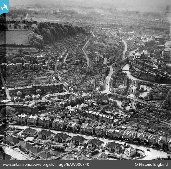
EAW000740 ENGLAND (1946). Widcombe and Beechen Cliff, Bath, from the east, 1946
© Copyright OpenStreetMap contributors and licensed by the OpenStreetMap Foundation. 2026. Cartography is licensed as CC BY-SA.
Details
| Title | [EAW000740] Widcombe and Beechen Cliff, Bath, from the east, 1946 |
| Reference | EAW000740 |
| Date | 9-May-1946 |
| Link | |
| Place name | BATH |
| Parish | |
| District | |
| Country | ENGLAND |
| Easting / Northing | 375624, 164186 |
| Longitude / Latitude | -2.3502570032306, 51.375706747168 |
| National Grid Reference | ST756642 |
Pins

ClareH |
Wednesday 10th of September 2025 10:04:50 PM | |

ClareH |
Wednesday 10th of September 2025 10:03:27 PM | |

clippedwings |
Thursday 2nd of July 2015 10:07:26 AM | |

Bonzellee |
Thursday 2nd of July 2015 09:26:12 AM | |

Class31 |
Monday 11th of November 2013 10:05:57 AM | |

james348 |
Sunday 13th of October 2013 08:39:12 PM |


![[EAW000740] Widcombe and Beechen Cliff, Bath, from the east, 1946](http://britainfromabove.org.uk/sites/all/libraries/aerofilms-images/public/100x100/EAW/000/EAW000740.jpg)
![[EAW000741] Widcombe Crescent looking towards Skew Bridge, Bath, 1946](http://britainfromabove.org.uk/sites/all/libraries/aerofilms-images/public/100x100/EAW/000/EAW000741.jpg)