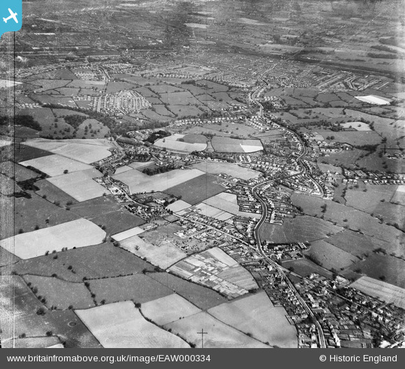
EAW000334 ENGLAND (1946). Wistaston with Crewe in the distance, Wistaston, from the south-west, 1946
© Copyright OpenStreetMap contributors and licensed by the OpenStreetMap Foundation. 2026. Cartography is licensed as CC BY-SA.
Nearby Images (5)
Details
| Title | [EAW000334] Wistaston with Crewe in the distance, Wistaston, from the south-west, 1946 |
| Reference | EAW000334 |
| Date | 19-April-1946 |
| Link | |
| Place name | WISTASTON |
| Parish | WISTASTON |
| District | |
| Country | ENGLAND |
| Easting / Northing | 368258, 353543 |
| Longitude / Latitude | -2.4738821295329, 53.077870218933 |
| National Grid Reference | SJ683535 |
Pins

Creweboy |
Sunday 17th of January 2016 09:06:56 PM |


![[EAW000334] Wistaston with Crewe in the distance, Wistaston, from the south-west, 1946](http://britainfromabove.org.uk/sites/all/libraries/aerofilms-images/public/100x100/EAW/000/EAW000334.jpg)
![[EAW000336] Wistaston with Crewe in the distance, Wistaston, from the south-west, 1946](http://britainfromabove.org.uk/sites/all/libraries/aerofilms-images/public/100x100/EAW/000/EAW000336.jpg)
![[EAW000339] Church Lane, Crewe Road and surrounding countryside, Wistaston, 1946](http://britainfromabove.org.uk/sites/all/libraries/aerofilms-images/public/100x100/EAW/000/EAW000339.jpg)
![[EAW000337] Wistaston with Crewe in the distance, Wistaston, from the west, 1946](http://britainfromabove.org.uk/sites/all/libraries/aerofilms-images/public/100x100/EAW/000/EAW000337.jpg)
![[EAW000341] Housing at Wells Green, Wistaston, 1946. This image has been produced from a print.](http://britainfromabove.org.uk/sites/all/libraries/aerofilms-images/public/100x100/EAW/000/EAW000341.jpg)