
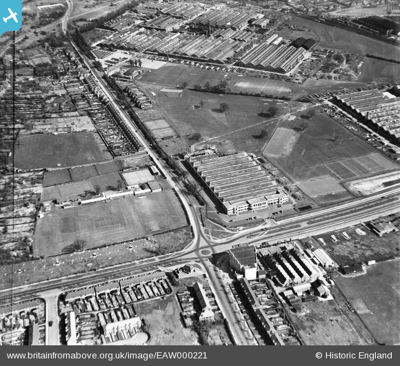
EAW000221 ENGLAND (1946). The Standard Motor Company works on Fletchampstead Highway, Coventry, 1946
© Copyright OpenStreetMap contributors and licensed by the OpenStreetMap Foundation. 2026. Cartography is licensed as CC BY-SA.
Nearby Images (21)
EAW000221

EAW000219

EAW000220

EPW053122

EPW053121

EAW000222

EPW053124

EAW000147

EPW053119

EAW000224

EPW047181

EAW000223

EPW047178

EPW053123

EAW000148

EPW047176

EPW047182

EPW047179

EPW047175

EPW047177

EPW053112

Details
| Title | [EAW000221] The Standard Motor Company works on Fletchampstead Highway, Coventry, 1946 |
| Reference | EAW000221 |
| Date | 15-April-1946 |
| Link | |
| Place name | COVENTRY |
| Parish | |
| District | |
| Country | ENGLAND |
| Easting / Northing | 430245, 278480 |
| Longitude / Latitude | -1.5553871560166, 52.403115487115 |
| National Grid Reference | SP302785 |
Pins

redmist |
Wednesday 7th of October 2020 09:53:44 PM | |
|
redmist |
Wednesday 7th of October 2020 09:53:03 PM | |
|
redmist |
Wednesday 7th of October 2020 09:52:27 PM | |
|
redmist |
Wednesday 7th of October 2020 09:51:08 PM | |
|
redmist |
Wednesday 7th of October 2020 09:50:26 PM | |

Sparky |
Thursday 31st of August 2017 09:53:43 PM |