
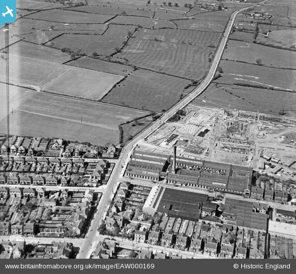
EAW000169 ENGLAND (1946). The Birchwood Mills, Wilsthorpe Road and the surrounding countryside, New Sawley, 1946. This image has been produced from a damaged negative.
© Copyright OpenStreetMap contributors and licensed by the OpenStreetMap Foundation. 2026. Cartography is licensed as CC BY-SA.
Nearby Images (8)
EAW000169

EAW000164

EAW000171

EAW000166

EAW000165

EAW000168

EAW000167

EAW000170

Details
| Title | [EAW000169] The Birchwood Mills, Wilsthorpe Road and the surrounding countryside, New Sawley, 1946. This image has been produced from a damaged negative. |
| Reference | EAW000169 |
| Date | 16-April-1946 |
| Link | |
| Place name | NEW SAWLEY |
| Parish | |
| District | |
| Country | ENGLAND |
| Easting / Northing | 447912, 332715 |
| Longitude / Latitude | -1.2878159636947, 52.889429989642 |
| National Grid Reference | SK479327 |
Pins

Sparky |
Friday 3rd of November 2017 12:21:06 AM |