
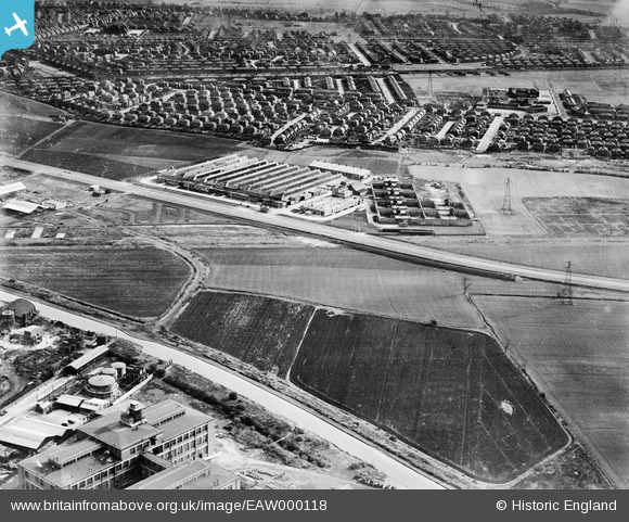
EAW000118 ENGLAND (1946). The Ford Motor Company shadow factory between the Longford Brook and Barton Dock Road, Trafford Park, 1946
© Copyright OpenStreetMap contributors and licensed by the OpenStreetMap Foundation. 2026. Cartography is licensed as CC BY-SA.
Nearby Images (5)
EAW000118

EAW000117

EAW000119

EAW000116

EAW000120

Details
| Title | [EAW000118] The Ford Motor Company shadow factory between the Longford Brook and Barton Dock Road, Trafford Park, 1946 |
| Reference | EAW000118 |
| Date | 5-April-1946 |
| Link | |
| Place name | TRAFFORD PARK |
| Parish | |
| District | |
| Country | ENGLAND |
| Easting / Northing | 378437, 395973 |
| Longitude / Latitude | -2.3247991455213, 53.459809848861 |
| National Grid Reference | SJ784960 |
Pins

redmist |
Sunday 6th of January 2019 06:18:01 PM | |
|
phloberts |
Saturday 12th of August 2017 08:09:26 PM | |
|
phloberts |
Saturday 12th of August 2017 08:01:08 PM | |
|
Stretfordian |
Saturday 23rd of January 2016 01:07:20 AM | |
|
Stretfordian |
Saturday 23rd of January 2016 01:04:09 AM | |
|
Rick |
Thursday 7th of January 2016 07:49:40 PM | |
|
Rick |
Thursday 7th of January 2016 07:47:34 PM | |
|
Rick |
Thursday 7th of January 2016 07:45:56 PM | |
|
Rick |
Thursday 7th of January 2016 07:45:01 PM | |
|
Rick |
Thursday 7th of January 2016 07:43:56 PM |