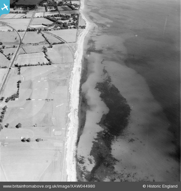
xaw044980 IRELAND (1952). General View, Bray, Dublin, Ireland, 1952. Oblique aerial photograph taken facing North.
© Copyright OpenStreetMap contributors and licensed by the OpenStreetMap Foundation. 2025. Cartography is licensed as CC BY-SA.
Details
| Title | [XAW044980] General View, Bray, Dublin, Ireland, 1952. Oblique aerial photograph taken facing North. |
| Reference | XAW044980 |
| Date | 1952 |
| Link | |
| Place name | BRAY |
| Parish | IRELAND |
| District | |
| Country | IRELAND |
| Easting / Northing | 126043, 377684 |
| Longitude / Latitude | -6.105907, 53.225361 |
| National Grid Reference |
Pins
 dfleeton |
Friday 5th of March 2021 12:45:20 AM |
User Comment Contributions
Not Bray but Woodbrook golf course. The line of the pre 1915 railway can just about be seen along the cliffs. The current rail line is on the left. The curves from both lines to the "Harcourt St" line, closed in the 1960'S, is visible top left. |
 Aidan |
Wednesday 5th of November 2014 12:59:24 AM |

