
Scheduled Maintenance
This website will undergo scheduled maintenance on Tuesday, September 10th, between 11:00 and 15:00, as well as on Thursday, September 12th, between 10:00 and 12:00. During this time, services may be temporarily disrupted. We apologise for any inconvenience.
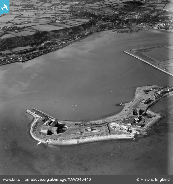
xaw040446 NORTHERN IRELAND (1951). General View, Larne, Larne, Northern Ireland, 1951. Oblique aerial photograph taken facing North/West.
© Copyright OpenStreetMap contributors and licensed by the OpenStreetMap Foundation. 2024. Cartography is licensed as CC BY-SA.
Nearby Images (3)
XAW040446

XAW040451

XAW040447

Details
| Title | [XAW040446] General View, Larne, Larne, Northern Ireland, 1951. Oblique aerial photograph taken facing North/West. |
| Reference | XAW040446 |
| Date | 28-September-1951 |
| Link | |
| Place name | LARNE |
| Parish | NORTHERN IRELAND |
| District | |
| Country | NORTHERN IRELAND |
| Easting / Northing | 156122, 556157 |
| Longitude / Latitude | -5.799772, 54.840665 |
| National Grid Reference |
Pins
 Stephen Craig |
Sunday 5th of April 2015 01:55:45 PM | |
Stephen Craig |
Sunday 5th of April 2015 01:55:40 PM | |
Stephen Craig |
Monday 1st of December 2014 01:46:59 PM | |
Stephen Craig |
Monday 1st of December 2014 01:46:32 PM | |
Stephen Craig |
Monday 1st of December 2014 01:45:27 PM | |
Stephen Craig |
Monday 1st of December 2014 01:43:53 PM | |
Stephen Craig |
Monday 1st of December 2014 01:42:48 PM |