
Scheduled Maintenance
This website will undergo scheduled maintenance on Tuesday, September 10th, between 11:00 and 15:00, as well as on Thursday, September 12th, between 10:00 and 12:00. During this time, services may be temporarily disrupted. We apologise for any inconvenience.
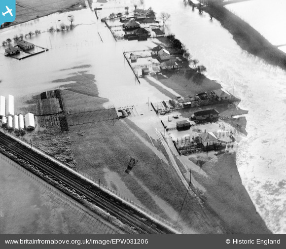
epw031206 ENGLAND (1929). The River Thames flood, Sunnymeads, 1929
© Copyright OpenStreetMap contributors and licensed by the OpenStreetMap Foundation. 2024. Cartography is licensed as CC BY-SA.
Details
| Title | [EPW031206] The River Thames flood, Sunnymeads, 1929 |
| Reference | EPW031206 |
| Date | December-1929 |
| Link | |
| Place name | SUNNYMEADS |
| Parish | WRAYSBURY |
| District | |
| Country | ENGLAND |
| Easting / Northing | 499975, 175672 |
| Longitude / Latitude | -0.56045378515478, 51.470683423665 |
| National Grid Reference | SU1000757 |
Pins
Be the first to add a comment to this image!