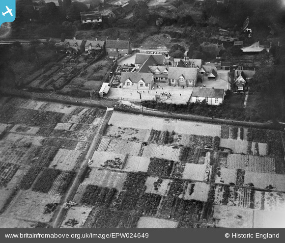
epw024649 ENGLAND (1928). Manor Road School, Didcot, 1928
© Copyright OpenStreetMap contributors and licensed by the OpenStreetMap Foundation. 2024. Cartography is licensed as CC BY-SA.
Details
| Title | [EPW024649] Manor Road School, Didcot, 1928 |
| Reference | EPW024649 |
| Date | September-1928 |
| Link | |
| Place name | DIDCOT |
| Parish | DIDCOT |
| District | |
| Country | ENGLAND |
| Easting / Northing | 451962, 190204 |
| Longitude / Latitude | -1.2495569403442, 51.607799092455 |
| National Grid Reference | SU520902 |
Pins
 Brightonboy |
Friday 30th of September 2016 08:26:12 AM | |
 Andy from Abingdon on Thames |
Thursday 29th of September 2016 10:08:23 PM | |
 Maurice |
Saturday 5th of July 2014 07:06:05 AM | |
 Class31 |
Tuesday 2nd of October 2012 08:34:01 AM | |
 Class31 |
Tuesday 2nd of October 2012 08:32:37 AM | |
 Class31 |
Tuesday 2nd of October 2012 08:31:46 AM |


![[EPW024649] Manor Road School, Didcot, 1928](http://britainfromabove.org.uk/sites/all/libraries/aerofilms-images/public/100x100/EPW/024/EPW024649.jpg)
![[EPW024651] The town, Didcot, from the south-east, 1928](http://britainfromabove.org.uk/sites/all/libraries/aerofilms-images/public/100x100/EPW/024/EPW024651.jpg)
![[EPW024652] Housing off Manor Road, Didcot, 1928. This image has been produced from a damaged negative.](http://britainfromabove.org.uk/sites/all/libraries/aerofilms-images/public/100x100/EPW/024/EPW024652.jpg)