
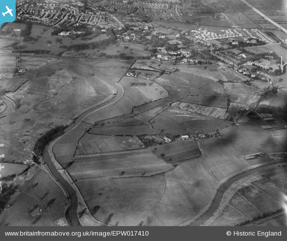
epw017410 ENGLAND (1927). The River Mersey at Didsbury Golf Course and Millgate Farm, East Didsbury, 1927
© Copyright OpenStreetMap contributors and licensed by the OpenStreetMap Foundation. 2025. Cartography is licensed as CC BY-SA.
Details
| Title | [EPW017410] The River Mersey at Didsbury Golf Course and Millgate Farm, East Didsbury, 1927 |
| Reference | EPW017410 |
| Date | 8-March-1927 |
| Link | |
| Place name | EAST DIDSBURY |
| Parish | |
| District | |
| Country | ENGLAND |
| Easting / Northing | 384223, 389875 |
| Longitude / Latitude | -2.2373411679334, 53.405197077267 |
| National Grid Reference | SJ842899 |
Pins
 IanWeinstock |
Tuesday 29th of December 2020 03:03:36 PM | |
didsburybloke |
Monday 7th of October 2019 10:19:54 PM | |
didsburybloke |
Monday 7th of October 2019 10:16:10 PM | |
didsburybloke |
Monday 7th of October 2019 10:11:18 PM | |
didsburybloke |
Monday 7th of October 2019 10:06:54 PM | |
darkdays |
Saturday 17th of November 2018 10:27:36 AM | |
John Ellis |
Monday 23rd of February 2015 01:08:01 PM | |
thirteen |
Sunday 22nd of February 2015 06:31:52 PM | |
tony.g |
Friday 14th of June 2013 11:03:51 PM | |
chuffmeister |
Friday 15th of March 2013 11:32:55 PM | |
John Ellis |
Saturday 13th of October 2012 05:56:51 PM | |
John Ellis |
Saturday 13th of October 2012 05:53:01 PM | |
The Towers, which was designed by Thomas Worthington and built between 1868 and 1872, it still very much in existence, and most certainly has not been demolished. The original building is clearly visible on Google Earth. |
Tony Nelson |
Friday 28th of November 2014 09:35:54 AM |
John Ellis |
Friday 12th of October 2012 05:40:04 PM | |
John Ellis |
Friday 12th of October 2012 05:38:27 PM | |
Merlin |
Friday 12th of October 2012 03:51:01 PM | |
I don't remember Willow Bank Farm when it was still standing, but I lived in Didsbury between 1997 and 2007 and grew up on the borders of Baguley, Brooklands and Timperley in the '50s and '60s, so even back then I knew the Didsbury area vaguely. But I still have a collection of local maps which I bought in the 1950s, as well as a number of even older ones that I picked up one way and another. That's one way of identifying farms and houses long gone. The other is the Chester Record Office's superb website - search "Cheshire Archives and Local Studies" and then click "Tithe Maps Online" - designed to make the Tithe Maps of the 1830s and '40s accessible, but which also has the 1875 and 1910 OS maps on line, and all can be compared with a modern street map, on parallel panes. Didsbury's not Cheshire, of course, but several of the on-line maps cover areas on the Lancashire side of the Mersey for a mile or two north, including the whole of Didsbury. I'd recommend the site to anyone interested in the local history of the area which is so fascinatingly brought to life by the "Britain from Above" photographs. |
John Ellis |
Friday 12th of October 2012 05:33:06 PM |
paul296 |
Thursday 12th of July 2012 12:09:41 AM | |
John Ellis |
Tuesday 10th of July 2012 12:11:34 AM | |
John Ellis |
Tuesday 10th of July 2012 12:10:50 AM | |
John Ellis |
Tuesday 10th of July 2012 12:09:42 AM | |
John Ellis |
Tuesday 10th of July 2012 12:07:25 AM | |
Will also become Didsbury Teachers College in the 1960's, 70's and 80's together with land to it's right. |
thirteen |
Sunday 22nd of February 2015 06:29:00 PM |
John Ellis |
Tuesday 10th of July 2012 12:05:38 AM | |
John Ellis |
Tuesday 10th of July 2012 12:04:42 AM | |
Also the setting for the early part of Howard Spring's "My Son, My Son" |
chuffmeister |
Friday 15th of March 2013 11:30:47 PM |
John Ellis |
Tuesday 10th of July 2012 12:01:52 AM | |
John Ellis |
Tuesday 10th of July 2012 12:01:18 AM | |
John Ellis |
Tuesday 10th of July 2012 12:00:44 AM | |
John Ellis |
Monday 9th of July 2012 11:59:41 PM | |
John Ellis |
Monday 9th of July 2012 11:59:11 PM | |
John Ellis |
Monday 9th of July 2012 11:57:16 PM | |
John Ellis |
Monday 9th of July 2012 11:55:42 PM | |
John Ellis |
Monday 9th of July 2012 11:52:23 PM | |
This is Kingston Road. Parrs Wood Road wasn't built until the 1930s |
Tony Nelson |
Friday 28th of November 2014 09:31:31 AM |
John Ellis |
Monday 9th of July 2012 11:51:37 PM | |
John Ellis |
Monday 9th of July 2012 11:49:55 PM | |
John Ellis |
Monday 9th of July 2012 11:49:03 PM | |
John Ellis |
Monday 9th of July 2012 11:48:07 PM | |
John Ellis |
Monday 9th of July 2012 11:47:16 PM | |
John Ellis |
Monday 9th of July 2012 11:46:03 PM | |
John Ellis |
Monday 9th of July 2012 11:45:23 PM | |
John Ellis |
Monday 9th of July 2012 11:44:46 PM | |
John Ellis |
Monday 9th of July 2012 11:43:55 PM | |
John Ellis |
Monday 9th of July 2012 11:42:35 PM | |
John Ellis |
Monday 9th of July 2012 11:41:59 PM | |
John Ellis |
Monday 9th of July 2012 11:40:17 PM | |
John Ellis |
Monday 9th of July 2012 11:39:14 PM | |
John Ellis |
Monday 9th of July 2012 11:38:36 PM | |
John Ellis |
Monday 9th of July 2012 11:36:43 PM | |
John Ellis |
Monday 9th of July 2012 11:35:53 PM | |
John Ellis |
Monday 9th of July 2012 11:34:54 PM | |
John Ellis |
Monday 9th of July 2012 11:32:50 PM | |
the original A34 was Wilmslow road,through Cheadle, up Schools Hill and through Long Lane etc past Cheadle Royal Mental Hospital which is also featured on this site. Kingsway Extension which was the bit from Parrs Wood ( The Gateway pub) to the river, ended in a roundabout, but was always intended to be part of a trunk road to the south ( some of which has finally happened!) the bridge over the mersey and the extension through Gatley to schools hill (Cheadle By Pass) opened in 1959. saw my first road accident on the bridge on the first day! |
darkdays |
Saturday 17th of November 2018 08:57:05 AM |
John Ellis |
Monday 9th of July 2012 11:29:53 PM |
User Comment Contributions
Thanks to Tony Nelson for both of his corrections; checking more carefully, I can see he's right - I'd incorrectly marked Kingston Road as Parrs Wood Road. I had thought that "the Towers" was gone under the office redevelopment, but hadn't checked it out - as Tony's right about Kingston Road, I'm sure he's correct about "the Towers" too! |
John Ellis |
Tuesday 23rd of December 2014 06:10:51 PM |