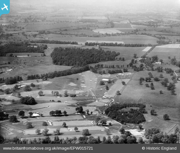
epw015721 ENGLAND (1926). Porters Park Golf Course, Radlett, from the south, 1926
© Copyright OpenStreetMap contributors and licensed by the OpenStreetMap Foundation. 2025. Cartography is licensed as CC BY-SA.
Details
| Title | [EPW015721] Porters Park Golf Course, Radlett, from the south, 1926 |
| Reference | EPW015721 |
| Date | May-1926 |
| Link | |
| Place name | RADLETT |
| Parish | ALDENHAM |
| District | |
| Country | ENGLAND |
| Easting / Northing | 517438, 200460 |
| Longitude / Latitude | -0.30082099583439, 51.690133551291 |
| National Grid Reference | TL174005 |
Pins
 Class31 |
Saturday 18th of August 2012 06:22:20 PM | |
 Class31 |
Saturday 18th of August 2012 06:20:22 PM | |
 Class31 |
Saturday 18th of August 2012 06:19:58 PM | |
 Class31 |
Saturday 18th of August 2012 06:18:48 PM | |
 Class31 |
Sunday 22nd of July 2012 11:32:39 PM | |
Ex Midland Railway LMS St. Pancras to Bedford and the north Midland Main Line |
 Class31 |
Saturday 18th of August 2012 06:24:12 PM |
 sparky454 |
Friday 20th of July 2012 05:46:21 PM | |
 HydeParkDave |
Monday 16th of July 2012 12:12:28 PM | |
 Eton Slaphead |
Monday 9th of July 2012 09:52:37 PM | |
 BigglesH |
Tuesday 26th of June 2012 11:07:41 PM |
User Comment Contributions
This is Porters Park Golf Course and the area shown is close to that on photo EPW 015783. It looks North, more or less. |
 Mark |
Tuesday 23rd of October 2012 03:26:45 PM |
Dear Mark, That’s great; we’ve reviewed your comment and thanks to your help we can update the catalogue. The revised record with the correct location will appear here in due course. You may be interested to know that the original Aerofilms Ltd Register entry for this image is "Wimbledon Common Golf Course". Yours, Katy Britain from Above Cataloguing Team Leader |
Katy Whitaker |
Tuesday 23rd of October 2012 03:26:45 PM |
Obviously Golf Course, but cannot see Clubhouse or approach road. |
 BigglesH |
Tuesday 26th of June 2012 11:11:48 PM |


![[EPW015721] Porters Park Golf Course, Radlett, from the south, 1926](http://britainfromabove.org.uk/sites/all/libraries/aerofilms-images/public/100x100/EPW/015/EPW015721.jpg)
![[EPW015737] Porters Park Golf Course and Estate, Radlett, from the west, 1926](http://britainfromabove.org.uk/sites/all/libraries/aerofilms-images/public/100x100/EPW/015/EPW015737.jpg)
![[EPW015744] Porters Park Golf Course, Radlett, from the south, 1926. This image has been produced from a copy-negative.](http://britainfromabove.org.uk/sites/all/libraries/aerofilms-images/public/100x100/EPW/015/EPW015744.jpg)