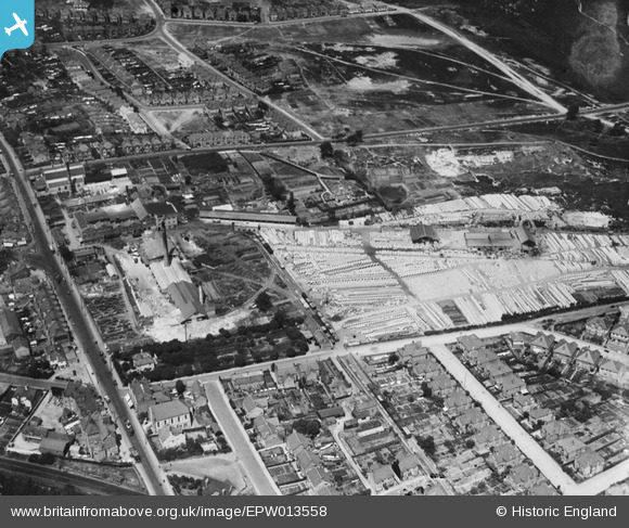
epw013558 ENGLAND (1925). Sharp, Jones and Co Ltd Bourne Valley Pottery, Branksome, 1925
© Copyright OpenStreetMap contributors and licensed by the OpenStreetMap Foundation. 2025. Cartography is licensed as CC BY-SA.
Details
| Title | [EPW013558] Sharp, Jones and Co Ltd Bourne Valley Pottery, Branksome, 1925 |
| Reference | EPW013558 |
| Date | June-1925 |
| Link | |
| Place name | BRANKSOME |
| Parish | |
| District | |
| Country | ENGLAND |
| Easting / Northing | 405607, 92128 |
| Longitude / Latitude | -1.9205492734714, 50.728171387503 |
| National Grid Reference | SZ056921 |
Pins
 SpongeLab |
Sunday 18th of October 2020 12:35:01 PM | |
 Barrie |
Friday 9th of January 2015 03:13:44 PM | |
 Barrie |
Friday 9th of January 2015 03:10:48 PM | |
 Peter Kazmierczak |
Wednesday 8th of October 2014 11:29:24 PM | |
 Peter Kazmierczak |
Wednesday 8th of October 2014 11:26:11 PM | |
 micky |
Thursday 3rd of January 2013 07:08:25 PM | |
 micky |
Thursday 3rd of January 2013 07:07:25 PM | |
 micky |
Thursday 3rd of January 2013 07:05:52 PM | |
 micky |
Thursday 3rd of January 2013 07:04:25 PM | |
 micky |
Thursday 3rd of January 2013 07:03:34 PM | |
 KeithFP |
Thursday 8th of November 2012 12:31:31 PM | |
 KeithFP |
Thursday 8th of November 2012 12:30:44 PM | |
 KeithFP |
Thursday 8th of November 2012 12:30:14 PM | |
 KeithFP |
Thursday 8th of November 2012 12:28:32 PM |

