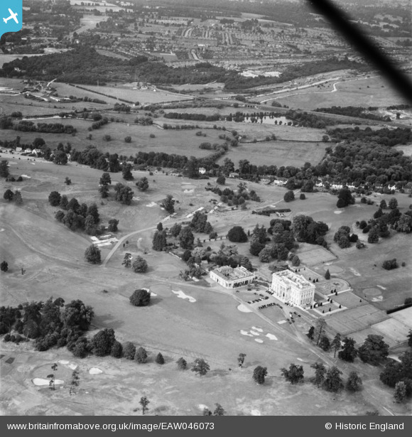
eaw046073 ENGLAND (1952). Moor Park Club House and Golf Course, Moor Park, 1952
© Copyright OpenStreetMap contributors and licensed by the OpenStreetMap Foundation. 2025. Cartography is licensed as CC BY-SA.
Nearby Images (7)
Details
| Title | [EAW046073] Moor Park Club House and Golf Course, Moor Park, 1952 |
| Reference | EAW046073 |
| Date | 21-August-1952 |
| Link | |
| Place name | MOOR PARK |
| Parish | |
| District | |
| Country | ENGLAND |
| Easting / Northing | 507448, 193577 |
| Longitude / Latitude | -0.44742005168565, 51.63026391896 |
| National Grid Reference | TQ074936 |
Pins
 Matt Aldred edob.mattaldred.com |
Saturday 25th of March 2023 07:46:27 PM | |
 Matt Aldred edob.mattaldred.com |
Saturday 25th of March 2023 07:43:30 PM |


![[EAW046073] Moor Park Club House and Golf Course, Moor Park, 1952](http://britainfromabove.org.uk/sites/all/libraries/aerofilms-images/public/100x100/EAW/046/EAW046073.jpg)
![[EAW046074] Moor Park Club House and Golf Course, Moor Park, 1952](http://britainfromabove.org.uk/sites/all/libraries/aerofilms-images/public/100x100/EAW/046/EAW046074.jpg)
![[EPW020991] Moor Park Club House and Golf Course, Moor Park, 1928](http://britainfromabove.org.uk/sites/all/libraries/aerofilms-images/public/100x100/EPW/020/EPW020991.jpg)
![[EAW015433] Moor Park Mansion and Golf Course, Moor Park, 1948. This image has been produced from a print.](http://britainfromabove.org.uk/sites/all/libraries/aerofilms-images/public/100x100/EAW/015/EAW015433.jpg)
![[EAW004292] The Moor Park Golf Course Club House, Moor Park, 1947](http://britainfromabove.org.uk/sites/all/libraries/aerofilms-images/public/100x100/EAW/004/EAW004292.jpg)
![[EPW039624] Moor Park House and Golf Course, Moor Park, 1932](http://britainfromabove.org.uk/sites/all/libraries/aerofilms-images/public/100x100/EPW/039/EPW039624.jpg)
![[EPW015338] Moor Park Mansion (the Club House), Moor Park, 1926](http://britainfromabove.org.uk/sites/all/libraries/aerofilms-images/public/100x100/EPW/015/EPW015338.jpg)