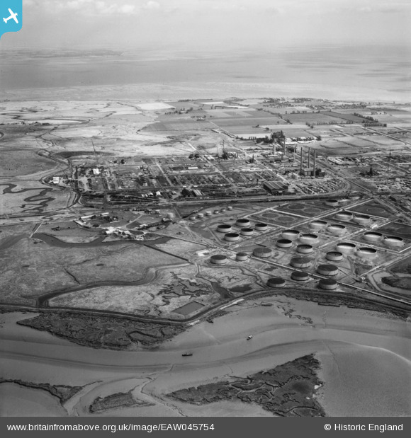
eaw045754 ENGLAND (1952). The Anglo-Iranian Oil Co Ltd Kent Oil Refinery under construction, Isle of Grain, from the south-west, 1952
© Copyright OpenStreetMap contributors and licensed by the OpenStreetMap Foundation. 2025. Cartography is licensed as CC BY-SA.
Details
| Title | [EAW045754] The Anglo-Iranian Oil Co Ltd Kent Oil Refinery under construction, Isle of Grain, from the south-west, 1952 |
| Reference | EAW045754 |
| Date | 12-August-1952 |
| Link | |
| Place name | ISLE OF GRAIN |
| Parish | ISLE OF GRAIN |
| District | |
| Country | ENGLAND |
| Easting / Northing | 585988, 174685 |
| Longitude / Latitude | 0.67641655393581, 51.440087964605 |
| National Grid Reference | TQ860747 |
Pins
 redmist |
Monday 24th of January 2022 11:20:48 PM | |
 Kentishman |
Saturday 23rd of January 2016 09:44:31 PM | |
 Kentishman |
Friday 31st of July 2015 10:31:37 PM |
User Comment Contributions
 Kentishman |
Saturday 23rd of January 2016 09:50:18 PM |


![[EAW045754] The Anglo-Iranian Oil Co Ltd Kent Oil Refinery under construction, Isle of Grain, from the south-west, 1952](http://britainfromabove.org.uk/sites/all/libraries/aerofilms-images/public/100x100/EAW/045/EAW045754.jpg)
![[EAW048520] The Anglo-Iranian Oil Co Ltd Kent Oil Refinery under construction, Isle of Grain, 1953. This image was marked by Aerofilms Ltd for photo editing.](http://britainfromabove.org.uk/sites/all/libraries/aerofilms-images/public/100x100/EAW/048/EAW048520.jpg)
![[EPW013203] The Medway Oil Storage Company Ltd, Isle of Grain, 1925](http://britainfromabove.org.uk/sites/all/libraries/aerofilms-images/public/100x100/EPW/013/EPW013203.jpg)
