
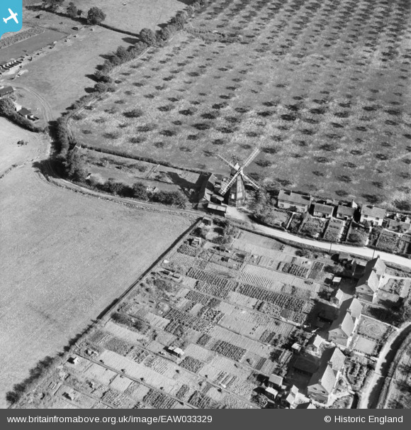
eaw033329 ENGLAND (1950). Terling Windmill, Terling, 1950
© Copyright OpenStreetMap contributors and licensed by the OpenStreetMap Foundation. 2025. Cartography is licensed as CC BY-SA.
Nearby Images (5)
EAW033329

EAW021047
, Terling, 1949. This image has been produced from a damaged negative.")
EAW033328

EAW021048
, Terling, 1949. This image has been produced from a damaged negative.")
EAW021049
, Terling, from the south, 1949. This image has been produced from a damaged negative.")
Details
| Title | [EAW033329] Terling Windmill, Terling, 1950 |
| Reference | EAW033329 |
| Date | 5-October-1950 |
| Link | |
| Place name | TERLING |
| Parish | TERLING |
| District | |
| Country | ENGLAND |
| Easting / Northing | 576423, 214999 |
| Longitude / Latitude | 0.55923016552671, 51.805305295148 |
| National Grid Reference | TL764150 |
Pins
 Matt Aldred edob.mattaldred.com |
Monday 9th of October 2023 09:45:54 AM |