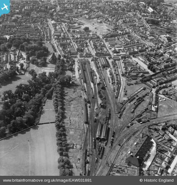
eaw031881 ENGLAND (1950). The railway station and environs, King's Lynn, 1950
© Copyright OpenStreetMap contributors and licensed by the OpenStreetMap Foundation. 2025. Cartography is licensed as CC BY-SA.
Details
| Title | [EAW031881] The railway station and environs, King's Lynn, 1950 |
| Reference | EAW031881 |
| Date | 14-August-1950 |
| Link | |
| Place name | KING'S LYNN |
| Parish | |
| District | |
| Country | ENGLAND |
| Easting / Northing | 562425, 320043 |
| Longitude / Latitude | 0.40698766450084, 52.753214371414 |
| National Grid Reference | TF624200 |
Pins
 redmist |
Monday 9th of December 2024 08:10:53 PM | |
 John W |
Sunday 26th of March 2017 10:22:09 PM | |
 John W |
Sunday 26th of March 2017 10:21:26 PM | |
 John W |
Sunday 26th of March 2017 10:20:16 PM | |
 Gen_Hancock |
Thursday 16th of March 2017 02:39:29 PM | |
 Class31 |
Thursday 11th of September 2014 01:12:41 PM | |
 Class31 |
Thursday 11th of September 2014 01:11:11 PM | |
 Class31 |
Thursday 11th of September 2014 01:10:37 PM | |
 Class31 |
Thursday 11th of September 2014 01:10:07 PM | |
 Class31 |
Thursday 11th of September 2014 01:09:30 PM | |
 Class31 |
Thursday 11th of September 2014 01:08:26 PM | |
 Class31 |
Thursday 11th of September 2014 01:06:52 PM | |
 Class31 |
Thursday 11th of September 2014 01:05:11 PM |


![[EAW031881] The railway station and environs, King's Lynn, 1950](http://britainfromabove.org.uk/sites/all/libraries/aerofilms-images/public/100x100/EAW/031/EAW031881.jpg)
![[EAW031883] The town centre, King's Lynn, 1950](http://britainfromabove.org.uk/sites/all/libraries/aerofilms-images/public/100x100/EAW/031/EAW031883.jpg)