
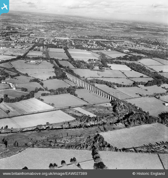
eaw027389 ENGLAND (1949). Crimple Valley Viaduct and environs, Follifoot, from the south-east, 1949
© Copyright OpenStreetMap contributors and licensed by the OpenStreetMap Foundation. 2025. Cartography is licensed as CC BY-SA.
Details
| Title | [EAW027389] Crimple Valley Viaduct and environs, Follifoot, from the south-east, 1949 |
| Reference | EAW027389 |
| Date | 24-October-1949 |
| Link | |
| Place name | FOLLIFOOT |
| Parish | FOLLIFOOT |
| District | |
| Country | ENGLAND |
| Easting / Northing | 432098, 452581 |
| Longitude / Latitude | -1.5106494088373, 53.968112036832 |
| National Grid Reference | SE321526 |
Pins
 YingTang |
Friday 20th of October 2023 12:28:33 AM | |
YingTang |
Friday 20th of October 2023 12:27:15 AM | |
Mortimer |
Wednesday 19th of August 2015 02:02:00 PM | |
Mortimer |
Wednesday 19th of August 2015 01:59:49 PM | |
Mortimer |
Wednesday 19th of August 2015 01:58:05 PM | |
Mortimer |
Wednesday 19th of August 2015 01:56:36 PM | |
John C |
Saturday 4th of October 2014 05:13:27 PM |