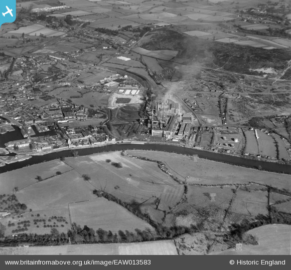
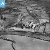
eaw013583 ENGLAND (1948). Stourport Power Station and environs, Stourport-on-Severn, 1948
© Copyright OpenStreetMap contributors and licensed by the OpenStreetMap Foundation. 2025. Cartography is licensed as CC BY-SA.
Nearby Images (21)
Details
| Title | [EAW013583] Stourport Power Station and environs, Stourport-on-Severn, 1948 |
| Reference | EAW013583 |
| Date | 9-March-1948 |
| Link | |
| Place name | STOURPORT-ON-SEVERN |
| Parish | STOURPORT-ON-SEVERN |
| District | |
| Country | ENGLAND |
| Easting / Northing | 381409, 270774 |
| Longitude / Latitude | -2.272870188556, 52.334350391221 |
| National Grid Reference | SO814708 |
Pins
 Cyberbia |
Monday 28th of March 2022 07:56:56 PM | |
 redmist |
Monday 1st of November 2021 11:31:50 PM | |
 redmist |
Monday 1st of November 2021 08:33:45 PM | |
 redmist |
Monday 1st of November 2021 08:32:55 PM | |
 Sparky |
Wednesday 26th of July 2017 03:08:09 PM | |
 Robert |
Sunday 15th of May 2016 09:13:07 PM | |
 Robert |
Sunday 15th of May 2016 09:09:50 PM | |
 Class31 |
Sunday 30th of August 2015 07:56:36 AM |
User Comment Contributions
Stourport-on-Severn, 15/08/2015 |
 Class31 |
Sunday 30th of August 2015 11:38:33 AM |
The Angel PH, Stourport-on-Severn, 15/08/2015 |
 Class31 |
Sunday 30th of August 2015 11:36:56 AM |
Stourport-on-Severn, 15/08/2015 |
 Class31 |
Sunday 30th of August 2015 07:55:16 AM |
Stourport-on-Severn, 15/08/2015 |
 Class31 |
Sunday 30th of August 2015 07:54:44 AM |
Stourport-on-Severn, 15/08/2015 |
 Class31 |
Sunday 30th of August 2015 07:54:08 AM |

