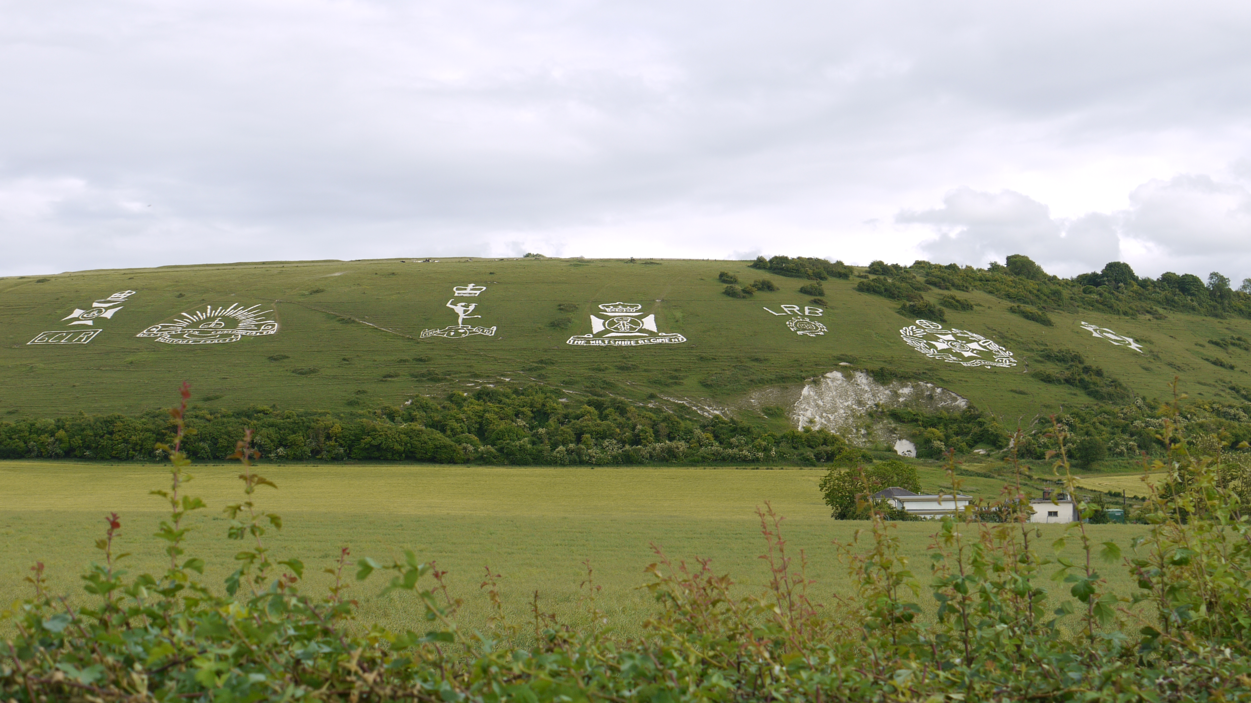
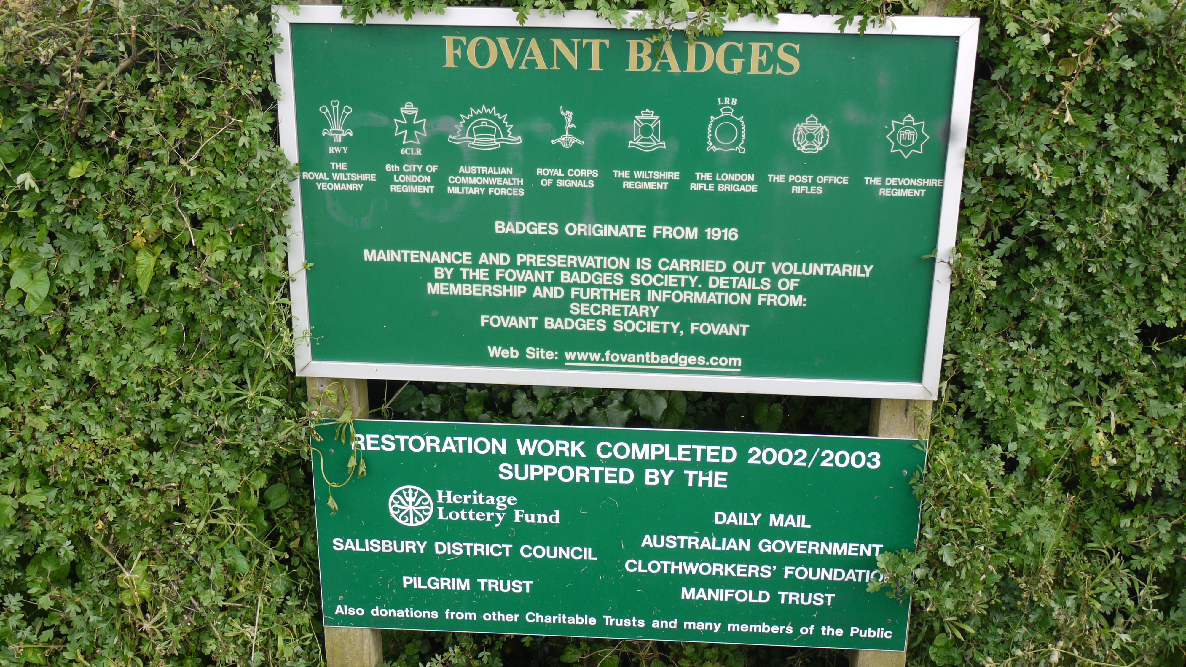
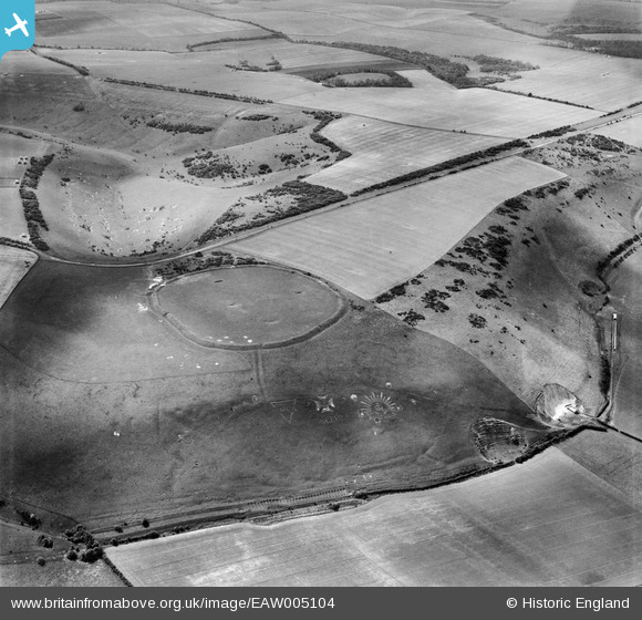
eaw005104 ENGLAND (1947). Chiselbury Camp hillfort and the Fovant Badges, Fovant, 1947
© Copyright OpenStreetMap contributors and licensed by the OpenStreetMap Foundation. 2025. Cartography is licensed as CC BY-SA.
Nearby Images (6)
EAW005104

EAW005105

EAW051989

EAW051991

EAW031929

EAW051994

Details
| Title | [EAW005104] Chiselbury Camp hillfort and the Fovant Badges, Fovant, 1947 |
| Reference | EAW005104 |
| Date | 7-September-1947 |
| Link | |
| Place name | FOVANT |
| Parish | FOVANT |
| District | |
| Country | ENGLAND |
| Easting / Northing | 401698, 128111 |
| Longitude / Latitude | -1.9757721744397, 51.051807131682 |
| National Grid Reference | SU017281 |
Pins
 RJAB |
Thursday 8th of January 2015 05:12:52 PM | |
 Laura Maddison |
Friday 24th of October 2014 10:27:40 AM | |
Laura Maddison |
Friday 24th of October 2014 10:19:59 AM | |
Laura Maddison |
Friday 24th of October 2014 10:18:49 AM |