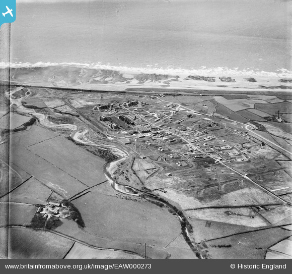
eaw000273 ENGLAND (1946). Royal Ordnance Factory at Sellafield, High Sellafield, 1946
© Copyright OpenStreetMap contributors and licensed by the OpenStreetMap Foundation. 2025. Cartography is licensed as CC BY-SA.
Nearby Images (8)
Details
| Title | [EAW000273] Royal Ordnance Factory at Sellafield, High Sellafield, 1946 |
| Reference | EAW000273 |
| Date | 24-April-1946 |
| Link | |
| Place name | HIGH SELLAFIELD |
| Parish | ST. BRIDGET BECKERMET |
| District | |
| Country | ENGLAND |
| Easting / Northing | 302707, 503653 |
| Longitude / Latitude | -3.4995583963162, 54.41885682284 |
| National Grid Reference | NY027037 |
Pins
 Brian |
Sunday 4th of September 2022 09:07:31 AM | |
 Brian |
Sunday 4th of September 2022 09:07:00 AM | |
 Brian |
Sunday 4th of September 2022 09:06:27 AM | |
 Matt Aldred edob.mattaldred.com |
Friday 26th of February 2021 04:32:24 PM | |
 Matt Aldred edob.mattaldred.com |
Friday 26th of February 2021 04:30:47 PM | |
 Matt Aldred edob.mattaldred.com |
Friday 26th of February 2021 04:30:28 PM | |
 Matt Aldred edob.mattaldred.com |
Friday 26th of February 2021 04:30:09 PM | |
 redmist |
Sunday 7th of February 2021 10:17:29 PM | |
 redmist |
Sunday 7th of February 2021 10:17:07 PM | |
 redmist |
Sunday 7th of February 2021 10:16:11 PM | |
 MB |
Monday 6th of October 2014 05:07:55 PM | |
 MB |
Monday 6th of October 2014 05:05:11 PM | |
 MB |
Monday 6th of October 2014 05:02:29 PM | |
 bescotbeast |
Sunday 5th of October 2014 12:17:08 PM |


