
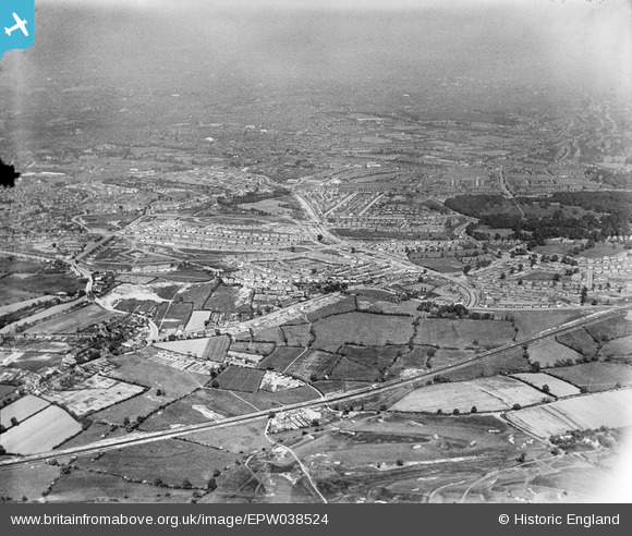
EPW038524 ENGLAND (1932). Wolverhampton Road and new housing estates surrounding Norman Road and Warley Park, Warley Woods, from the west, 1932
© Copyright OpenStreetMap contributors and licensed by the OpenStreetMap Foundation. 2024. Cartography is licensed as CC BY-SA.
Details
| Title | [EPW038524] Wolverhampton Road and new housing estates surrounding Norman Road and Warley Park, Warley Woods, from the west, 1932 |
| Reference | EPW038524 |
| Date | June-1932 |
| Link | |
| Place name | WARLEY WOODS |
| Parish | |
| District | |
| Country | ENGLAND |
| Easting / Northing | 399883, 286516 |
| Longitude / Latitude | -2.001722787801, 52.476203694397 |
| National Grid Reference | SO999865 |
Pins
 Kevin |
Saturday 13th of August 2016 01:55:14 AM | |
Kevin |
Saturday 13th of August 2016 01:54:46 AM | |
Kevin |
Saturday 13th of August 2016 01:53:49 AM | |
Oldburyman |
Tuesday 5th of January 2016 03:43:05 PM | |
Stormy78 |
Thursday 24th of July 2014 10:00:18 AM | |
Steve Cemm |
Monday 4th of March 2013 12:49:45 PM |