
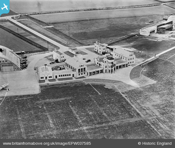
EPW037585 ENGLAND (1932). Heston Airport buildings, Heston, 1932
© Copyright OpenStreetMap contributors and licensed by the OpenStreetMap Foundation. 2024. Cartography is licensed as CC BY-SA.
Nearby Images (48)
EPW037586

EPW031393

EPW037522

EPW038207

EPW036078

EPW028591

EPW037933

EPW040089

EPW040090

EPW038201

EPW053980

EPW031395

EPW037938

EPW038205

EPW044693

EPW031394

EPW037936

EPW028210

EPW044699

EPW033771

EPW028592

EPW036080

EPW037902

EPW033767

EPW061093

EPW036120

EPW060375

EPW037901

EPW060377

EPW037937

EPW037989

EPW038204

EPW037941

EPW037338

EPW031396

EPW031397

EPW028213

EPW034901

EPW041419

EPW033759

EPW037940

EPW041420

EPW025552

EPW037939

EPW037993

EPW037992

EPW036079

EPW044695

Details
| Title | [EPW037585] Heston Airport buildings, Heston, 1932 |
| Reference | EPW037585 |
| Date | April-1932 |
| Link | |
| Place name | HESTON |
| Parish | |
| District | |
| Country | ENGLAND |
| Easting / Northing | 511324, 177678 |
| Longitude / Latitude | -0.39647176245646, 51.48659595442 |
| National Grid Reference | TQ113777 |
Pins
Be the first to add a comment to this image!
User Comment Contributions
Worth comparing this image with EPW028209 taken in July 1929 - noticeable development of the terminal in less than three years |
 MB |
Thursday 27th of December 2012 11:00:10 PM |


