
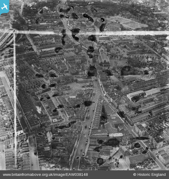
EAW038148 ENGLAND (1951). Lawrence Hill and Clarence Road, Bristol, 1951. This image has been produced from a damaged negative.
© Copyright OpenStreetMap contributors and licensed by the OpenStreetMap Foundation. 2026. Cartography is licensed as CC BY-SA.
Nearby Images (11)
EAW038148

EAW038154

EAW038149

EAW038151

EAW038150

EAW038155

EAW038152

EAW038157

EAW038147

EAW038156

EAW038153

Details
| Title | [EAW038148] Lawrence Hill and Clarence Road, Bristol, 1951. This image has been produced from a damaged negative. |
| Reference | EAW038148 |
| Date | 25-July-1951 |
| Link | |
| Place name | BRISTOL |
| Parish | |
| District | |
| Country | ENGLAND |
| Easting / Northing | 360197, 173377 |
| Longitude / Latitude | -2.5729491924771, 51.457481730347 |
| National Grid Reference | ST602734 |
Pins

Budget |
Sunday 1st of January 2023 07:29:23 PM | |
|
Budget |
Sunday 1st of January 2023 07:29:03 PM | |
|
Budget |
Sunday 1st of January 2023 07:27:58 PM | |
|
SpencerDudeUK |
Tuesday 11th of June 2019 12:22:51 PM |