
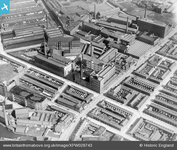
xpw028743 NORTHERN IRELAND (1929). Forth Flex Spinning Mill, Belfast, Belfast, Northern Ireland, 1929. Oblique aerial photograph taken facing North.
© Copyright OpenStreetMap contributors and licensed by the OpenStreetMap Foundation. 2025. Cartography is licensed as CC BY-SA.
Nearby Images (2)
XPW028743

XAW032845

Details
| Title | [XPW028743] Forth Flex Spinning Mill, Belfast, Belfast, Northern Ireland, 1929. Oblique aerial photograph taken facing North. |
| Reference | XPW028743 |
| Date | 1929 |
| Link | |
| Place name | NEWTOWNABBEY |
| Parish | NORTHERN IRELAND |
| District | |
| Country | NORTHERN IRELAND |
| Easting / Northing | 144955, 529877 |
| Longitude / Latitude | -5.950225, 54.599505 |
| National Grid Reference |
Pins
 poe |
Wednesday 18th of March 2020 09:39:53 PM | |
Dave S |
Sunday 31st of July 2016 12:10:22 PM | |
 |
Dave S |
Sunday 31st of July 2016 12:05:22 PM |