
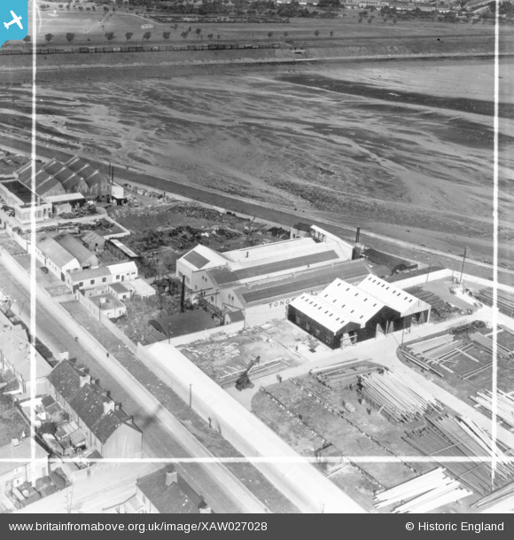
xaw027028 IRELAND (1949). Tonge and Taggart Ltd, Iron Foundry, East Wall Lane, Dublin, Dublin, Ireland, 1949. Oblique aerial photograph taken facing North. This image was marked by Aerofilms Ltd for photo editing.
© Copyright OpenStreetMap contributors and licensed by the OpenStreetMap Foundation. 2026. Cartography is licensed as CC BY-SA.
Nearby Images (7)
XAW027028

XAW027027

XAW027029

XAW027031

XAW027030

XAW027025

XAW027026

Details
| Title | [XAW027028] Tonge and Taggart Ltd, Iron Foundry, East Wall Lane, Dublin, Dublin, Ireland, 1949. Oblique aerial photograph taken facing North. This image was marked by Aerofilms Ltd for photo editing. |
| Reference | XAW027028 |
| Date | 30-September-1949 |
| Link | |
| Place name | DUBLIN |
| Parish | IRELAND |
| District | |
| Country | IRELAND |
| Easting / Northing | 118549, 392738 |
| Longitude / Latitude | -6.231187, 53.35639 |
| National Grid Reference |
Pins
Be the first to add a comment to this image!