wpw029420 WALES (1929). View of Cardiff showing docks and Butetown, oblique aerial view. 5"x4" black and white glass plate negative.
© Copyright OpenStreetMap contributors and licensed by the OpenStreetMap Foundation. 2024. Cartography is licensed as CC BY-SA.
Nearby Images (29)
Details
| Title | [WPW029420] View of Cardiff showing docks and Butetown, oblique aerial view. 5"x4" black and white glass plate negative. |
| Reference | WPW029420 |
| Date | 1929 |
| Link | Coflein Archive Item 6378032 |
| Place name | |
| Parish | |
| District | |
| Country | WALES |
| Easting / Northing | 319000, 174000 |
| Longitude / Latitude | -3.1660087748727, 51.458686385872 |
| National Grid Reference | ST190740 |
Pins
 Richard |
Sunday 12th of June 2022 02:30:41 AM | |
 Susan Brown |
Sunday 4th of October 2020 12:09:38 PM | |
 gBr |
Wednesday 14th of June 2017 02:47:50 PM | |
 gBr |
Wednesday 14th of June 2017 02:32:15 PM | |
 gBr |
Wednesday 14th of June 2017 02:26:36 PM | |
 gBr |
Wednesday 14th of June 2017 02:24:55 PM | |
 gBr |
Wednesday 14th of June 2017 02:23:31 PM | |
 gBr |
Wednesday 14th of June 2017 02:22:45 PM | |
 gBr |
Wednesday 14th of June 2017 02:17:43 PM | |
 gBr |
Wednesday 14th of June 2017 02:12:36 PM | |
 Topsin |
Tuesday 13th of September 2016 07:05:09 AM | |
 Johnny C |
Tuesday 18th of November 2014 09:13:29 AM | |
 Class31 |
Tuesday 29th of July 2014 08:19:52 AM | |
 rayray |
Wednesday 15th of January 2014 04:42:31 PM | |
 Alan McFaden |
Friday 18th of October 2013 03:22:34 PM | |
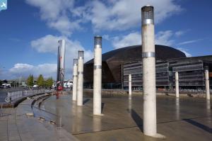
This is not quite correct. This is the approximate site of the 'Merchant Sefarers' memorial. See: http://www.dphotographer.co.uk/users/8504/thm1024/dsc01798.jpg The Scott Memorial is about 50ft to the northwest of the Roath Basin dock entrance (which is now disused). |
 hjr |
Wednesday 8th of January 2014 12:13:55 AM |
Sorry - meant to add, the location of the Scott Memorial is actually out of shot in this picture. |
 hjr |
Wednesday 8th of January 2014 12:15:04 AM |
This is the site for the Merchant Navy Memorial. |
 Topsin |
Tuesday 13th of September 2016 07:09:21 AM |
 Alan McFaden |
Friday 18th of October 2013 03:19:49 PM | |
 Alan McFaden |
Friday 18th of October 2013 03:16:13 PM | |
 Alan McFaden |
Friday 18th of October 2013 03:12:18 PM | |
 Alan McFaden |
Friday 18th of October 2013 03:10:27 PM | |
 kictm1 |
Monday 6th of August 2012 11:17:53 AM | |
 Chelsea61 |
Friday 29th of June 2012 06:41:36 PM | |
 Chelsea61 |
Friday 29th of June 2012 06:40:20 PM | |
 Chelsea61 |
Friday 29th of June 2012 06:39:57 PM |


![[WAW005380] View of Cardiff Docks](http://britainfromabove.org.uk/sites/all/libraries/aerofilms-images/public/100x100/WAW/005/WAW005380.jpg)
![[WAW005381] View of Cardiff Docks](http://britainfromabove.org.uk/sites/all/libraries/aerofilms-images/public/100x100/WAW/005/WAW005381.jpg)
![[WAW005382] View of Cardiff Docks](http://britainfromabove.org.uk/sites/all/libraries/aerofilms-images/public/100x100/WAW/005/WAW005382.jpg)
![[WAW007810] View of Cardiff docks from the south with Queen Alexandra dock in the foreground. Oblique aerial photograph, 5½" cut roll film.](http://britainfromabove.org.uk/sites/all/libraries/aerofilms-images/public/100x100/WAW/007/WAW007810.jpg)
![[WAW007811] View of Cardiff docks from the south with Queen Alexandra dock in the foreground. Oblique aerial photograph, 5½" cut roll film.](http://britainfromabove.org.uk/sites/all/libraries/aerofilms-images/public/100x100/WAW/007/WAW007811.jpg)
![[WAW007813] View of Cardiff docks from the south with Queen Alexandra dock in the foreground. Oblique aerial photograph, 5½" cut roll film.](http://britainfromabove.org.uk/sites/all/libraries/aerofilms-images/public/100x100/WAW/007/WAW007813.jpg)
![[WAW007815] Distant view of Cardiff docks. Oblique aerial photograph, 5½" cut roll film.](http://britainfromabove.org.uk/sites/all/libraries/aerofilms-images/public/100x100/WAW/007/WAW007815.jpg)
![[WAW007818] View of Cardiff docks from the south showing East and West Butes docks. Oblique aerial photograph, 5½" cut roll film.](http://britainfromabove.org.uk/sites/all/libraries/aerofilms-images/public/100x100/WAW/007/WAW007818.jpg)
![[WAW007823] View of Cardiff docks from the east with Roath dock in the foreground. Oblique aerial photograph, 5½" cut roll film.](http://britainfromabove.org.uk/sites/all/libraries/aerofilms-images/public/100x100/WAW/007/WAW007823.jpg)
![[WAW007825] View of Cardiff docks from the west. Oblique aerial photograph, 5½" cut roll film.](http://britainfromabove.org.uk/sites/all/libraries/aerofilms-images/public/100x100/WAW/007/WAW007825.jpg)
![[WAW007827] View of Cardiff docks from the south with Queen Alexandra dock in the foreground. Oblique aerial photograph, 5½" cut roll film.](http://britainfromabove.org.uk/sites/all/libraries/aerofilms-images/public/100x100/WAW/007/WAW007827.jpg)
![[WAW033669] General view of Cardiff docks](http://britainfromabove.org.uk/sites/all/libraries/aerofilms-images/public/100x100/WAW/033/WAW033669.jpg)
![[WAW033672] General view of Cardiff docks](http://britainfromabove.org.uk/sites/all/libraries/aerofilms-images/public/100x100/WAW/033/WAW033672.jpg)
![[WAW033676] General view of Cardiff docks](http://britainfromabove.org.uk/sites/all/libraries/aerofilms-images/public/100x100/WAW/033/WAW033676.jpg)
![[WPW006077] General view of Cardiff docks, oblique aerial view. 5"x4" black and white glass plate negative.](http://britainfromabove.org.uk/sites/all/libraries/aerofilms-images/public/100x100/WPW/006/WPW006077.jpg)
![[WPW006078] View of Queens Dock, Cardiff showing railway sidings, oblique aerial view. 5"x4" black and white glass plate negative.](http://britainfromabove.org.uk/sites/all/libraries/aerofilms-images/public/100x100/WPW/006/WPW006078.jpg)
![[WPW006079] General view of Cardiff docks, oblique aerial view. 5"x4" black and white glass plate negative.](http://britainfromabove.org.uk/sites/all/libraries/aerofilms-images/public/100x100/WPW/006/WPW006079.jpg)
![[WPW006080] General view of Cardiff docks, oblique aerial view. 5"x4" black and white glass plate negative.](http://britainfromabove.org.uk/sites/all/libraries/aerofilms-images/public/100x100/WPW/006/WPW006080.jpg)
![[WPW029420] View of Cardiff showing docks and Butetown, oblique aerial view. 5"x4" black and white glass plate negative.](http://britainfromabove.org.uk/sites/all/libraries/aerofilms-images/public/100x100/WPW/029/WPW029420.jpg)
![[WPW029431] View of Cardiff showing Bute East Dock, oblique aerial view. 5"x4" black and white glass plate negative.](http://britainfromabove.org.uk/sites/all/libraries/aerofilms-images/public/100x100/WPW/029/WPW029431.jpg)
![[WPW029432] View of Cardiff showing Bute East Dock and East Moors Works, oblique aerial view. 5"x4" black and white glass plate negative.](http://britainfromabove.org.uk/sites/all/libraries/aerofilms-images/public/100x100/WPW/029/WPW029432.jpg)
![[WPW041270] View of Cardiff Docks, oblique aerial view. 5"x4" black and white glass plate negative.](http://britainfromabove.org.uk/sites/all/libraries/aerofilms-images/public/100x100/WPW/041/WPW041270.jpg)
![[WPW041271] View of Cardiff Docks, oblique aerial view. 5"x4" black and white glass plate negative.](http://britainfromabove.org.uk/sites/all/libraries/aerofilms-images/public/100x100/WPW/041/WPW041271.jpg)
![[WPW041272] View of Cardiff Docks, oblique aerial view. 5"x4" black and white glass plate negative.](http://britainfromabove.org.uk/sites/all/libraries/aerofilms-images/public/100x100/WPW/041/WPW041272.jpg)
![[WPW041273] View of Cardiff Docks, oblique aerial view. 5"x4" black and white glass plate negative.](http://britainfromabove.org.uk/sites/all/libraries/aerofilms-images/public/100x100/WPW/041/WPW041273.jpg)
![[WPW052630] Distant view of Cardiff docks, oblique aerial view. 5"x4" black and white glass plate negative.](http://britainfromabove.org.uk/sites/all/libraries/aerofilms-images/public/100x100/WPW/052/WPW052630.jpg)
![[WPW054860] View of cardiff docks, oblique aerial view. 5"x4" black and white glass plate negative.](http://britainfromabove.org.uk/sites/all/libraries/aerofilms-images/public/100x100/WPW/054/WPW054860.jpg)
![[WPW054866] General view of cardiff docks, oblique aerial view. 5"x4" black and white glass plate negative.](http://britainfromabove.org.uk/sites/all/libraries/aerofilms-images/public/100x100/WPW/054/WPW054866.jpg)
![[WPW054867] General view of cardiff docks, oblique aerial view. 5"x4" black and white glass plate negative.](http://britainfromabove.org.uk/sites/all/libraries/aerofilms-images/public/100x100/WPW/054/WPW054867.jpg)


