
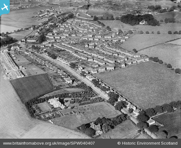
spw040407 SCOTLAND (1932). Brucefield House Estate and Aberdour Road, Dunfermline. An oblique aerial photograph taken facing north-west.
© Copyright OpenStreetMap contributors and licensed by the OpenStreetMap Foundation. 2026. Cartography is licensed as CC BY-SA.
Details
| Title | [SPW040407] Brucefield House Estate and Aberdour Road, Dunfermline. An oblique aerial photograph taken facing north-west. |
| Reference | SPW040407 |
| Date | 1932 |
| Link | NRHE Collection item 1257479 |
| Place name | |
| Parish | DUNFERMLINE |
| District | DUNFERMLINE |
| Country | SCOTLAND |
| Easting / Northing | 310458, 686417 |
| Longitude / Latitude | -3.4382172603556, 56.062259013919 |
| National Grid Reference | NT105864 |
