
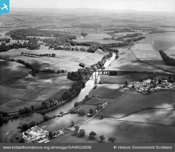
saw016838 SCOTLAND (1948). Roxburgh Viaduct and River Teviot. An oblique aerial photograph taken facing south.
© Copyright OpenStreetMap contributors and licensed by the OpenStreetMap Foundation. 2026. Cartography is licensed as CC BY-SA.
Details
| Title | [SAW016838] Roxburgh Viaduct and River Teviot. An oblique aerial photograph taken facing south. |
| Reference | SAW016838 |
| Date | 1948 |
| Link | NRHE Collection item 1269050 |
| Place name | |
| Parish | ROXBURGH |
| District | ROXBURGH |
| Country | SCOTLAND |
| Easting / Northing | 370200, 630413 |
| Longitude / Latitude | -2.4725823492911, 55.56647418339 |
| National Grid Reference | NT702304 |
