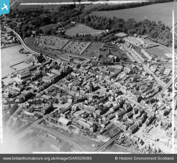
sar029086 SCOTLAND (1957). General View Dalkeith, Midlothian, Scotland. An oblique aerial photograph taken facing West. This image was marked by AeroPictorial Ltd for photo editing.
© Copyright OpenStreetMap contributors and licensed by the OpenStreetMap Foundation. 2024. Cartography is licensed as CC BY-SA.
Details
| Title | [SAR029086] General View Dalkeith, Midlothian, Scotland. An oblique aerial photograph taken facing West. This image was marked by AeroPictorial Ltd for photo editing. |
| Reference | SAR029086 |
| Date | 1957 |
| Link | Canmore Collection item 1438499 |
| Place name | |
| Parish | DALKEITH |
| District | MIDLOTHIAN |
| Country | SCOTLAND |
| Easting / Northing | 333960, 667090 |
| Longitude / Latitude | -3.0560731599156, 55.892441240322 |
| National Grid Reference | NT340671 |
Pins
 Billy Turner |
Tuesday 17th of November 2015 03:53:55 PM | |
 Regentlad |
Friday 17th of October 2014 11:53:33 AM | |
Regentlad |
Friday 17th of October 2014 11:51:53 AM | |
Regentlad |
Friday 17th of October 2014 11:50:30 AM | |
Regentlad |
Friday 17th of October 2014 11:45:07 AM | |
Regentlad |
Friday 17th of October 2014 11:44:06 AM | |
Regentlad |
Friday 17th of October 2014 11:43:17 AM | |
Regentlad |
Friday 17th of October 2014 11:42:31 AM | |
Andy A |
Monday 13th of October 2014 10:48:25 PM | |
Andy A |
Monday 13th of October 2014 10:46:10 PM |