
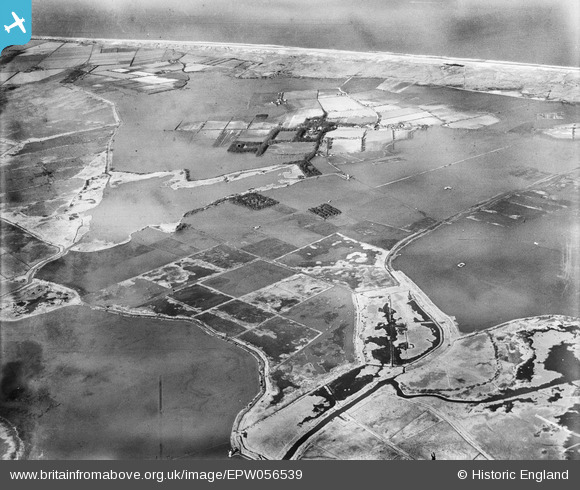
epw056539 ENGLAND (1938). Flooded countryside around Horsey Mere, Horsey, 1938
© Copyright OpenStreetMap contributors and licensed by the OpenStreetMap Foundation. 2024. Cartography is licensed as CC BY-SA.
Nearby Images (2)
EPW056539

EPW056542

Details
| Title | [EPW056539] Flooded countryside around Horsey Mere, Horsey, 1938 |
| Reference | EPW056539 |
| Date | 12-March-1938 |
| Link | |
| Place name | HORSEY |
| Parish | HORSEY |
| District | |
| Country | ENGLAND |
| Easting / Northing | 645367, 321702 |
| Longitude / Latitude | 1.6351120857027, 52.736826702411 |
| National Grid Reference | TG454217 |
Pins
 Class31 |
Tuesday 13th of August 2013 12:53:33 PM | |
Class31 |
Tuesday 13th of August 2013 12:52:49 PM | |
Class31 |
Tuesday 13th of August 2013 12:52:12 PM | |
Class31 |
Tuesday 13th of August 2013 12:49:57 PM | |
Class31 |
Tuesday 13th of August 2013 12:49:18 PM | |
Class31 |
Tuesday 13th of August 2013 12:44:46 PM | |
Class31 |
Tuesday 13th of August 2013 12:43:33 PM | |
Class31 |
Tuesday 13th of August 2013 12:36:52 PM |