
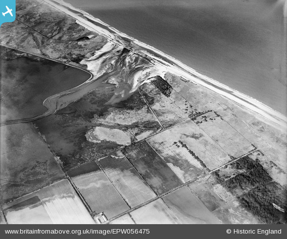
epw056475 ENGLAND (1938). Flooding following a breach of the sea defences at the discharge point of the Hundred Stream, Winterton Ness, 1938
© Copyright OpenStreetMap contributors and licensed by the OpenStreetMap Foundation. 2025. Cartography is licensed as CC BY-SA.
Details
| Title | [EPW056475] Flooding following a breach of the sea defences at the discharge point of the Hundred Stream, Winterton Ness, 1938 |
| Reference | EPW056475 |
| Date | 12-March-1938 |
| Link | |
| Place name | WINTERTON NESS |
| Parish | WINTERTON-ON-SEA |
| District | |
| Country | ENGLAND |
| Easting / Northing | 647905, 322032 |
| Longitude / Latitude | 1.6728780513582, 52.73863018819 |
| National Grid Reference | TG479220 |
Pins
Be the first to add a comment to this image!