
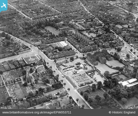
epw053711 ENGLAND (1937). Kettering Cemetery, the Cattle Market and Kettering Grammar School, Kettering, 1937
© Copyright OpenStreetMap contributors and licensed by the OpenStreetMap Foundation. 2025. Cartography is licensed as CC BY-SA.
Details
| Title | [EPW053711] Kettering Cemetery, the Cattle Market and Kettering Grammar School, Kettering, 1937 |
| Reference | EPW053711 |
| Date | June-1937 |
| Link | |
| Place name | KETTERING |
| Parish | |
| District | |
| Country | ENGLAND |
| Easting / Northing | 486835, 278254 |
| Longitude / Latitude | -0.72370264366319, 52.395029873348 |
| National Grid Reference | SP868783 |
Pins
 kevamb |
Friday 25th of April 2014 10:37:25 PM | |
kevamb |
Friday 25th of April 2014 10:35:48 PM | |
kevamb |
Friday 25th of April 2014 10:34:23 PM | |
kevamb |
Friday 25th of April 2014 10:32:11 PM | |
kevamb |
Friday 25th of April 2014 10:30:26 PM | |
kevamb |
Friday 1st of November 2013 11:31:00 AM | |
kevamb |
Friday 1st of November 2013 11:30:03 AM | |
kevamb |
Friday 1st of November 2013 11:29:25 AM |