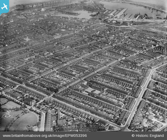
epw053396 ENGLAND (1937). Residential area between Grant Thorold Park and the docks, Grimsby, from the south-east, 1937
© Copyright OpenStreetMap contributors and licensed by the OpenStreetMap Foundation. 2025. Cartography is licensed as CC BY-SA.
Details
| Title | [EPW053396] Residential area between Grant Thorold Park and the docks, Grimsby, from the south-east, 1937 |
| Reference | EPW053396 |
| Date | 31-May-1937 |
| Link | |
| Place name | GRIMSBY |
| Parish | |
| District | |
| Country | ENGLAND |
| Easting / Northing | 528499, 409617 |
| Longitude / Latitude | -0.059441285952931, 53.567162202569 |
| National Grid Reference | TA285096 |
Pins
 Class31 |
Tuesday 4th of March 2014 07:35:38 PM | |
 Class31 |
Tuesday 4th of March 2014 07:34:58 PM | |
 Class31 |
Tuesday 4th of March 2014 07:34:04 PM | |
 Class31 |
Tuesday 4th of March 2014 07:33:35 PM | |
 Class31 |
Tuesday 4th of March 2014 07:33:01 PM | |
 Class31 |
Tuesday 4th of March 2014 07:32:42 PM |

