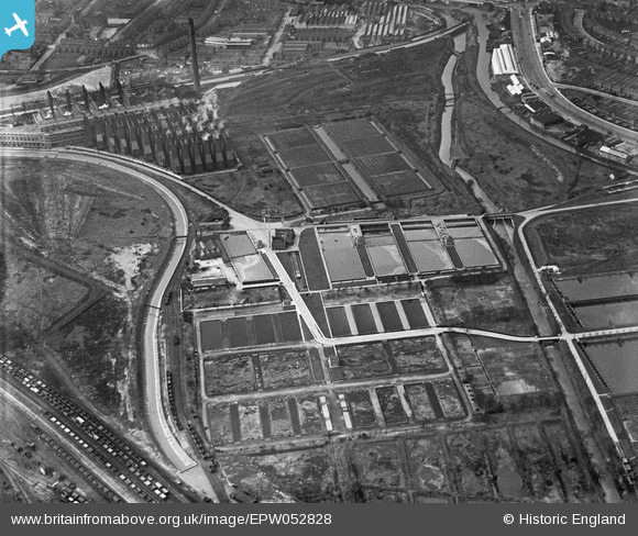
epw052828 ENGLAND (1937). Filter Beds at the Birmingham Tame & Rea District Drainage Board Sewage Farm, Nechells, 1937
© Copyright OpenStreetMap contributors and licensed by the OpenStreetMap Foundation. 2025. Cartography is licensed as CC BY-SA.
Details
| Title | [EPW052828] Filter Beds at the Birmingham Tame & Rea District Drainage Board Sewage Farm, Nechells, 1937 |
| Reference | EPW052828 |
| Date | 9-April-1937 |
| Link | |
| Place name | NECHELLS |
| Parish | |
| District | |
| Country | ENGLAND |
| Easting / Northing | 410180, 289599 |
| Longitude / Latitude | -1.850008746151, 52.503827885172 |
| National Grid Reference | SP102896 |
Pins
 Martin |
Tuesday 3rd of January 2017 07:10:26 PM | |
 stardelta |
Wednesday 6th of January 2016 05:33:35 PM | |
 stardelta |
Wednesday 6th of January 2016 05:32:49 PM | |
 Martin |
Wednesday 15th of January 2014 10:01:58 PM | |
 PURCELL |
Sunday 17th of November 2013 06:09:01 PM | |
 frothy |
Tuesday 27th of August 2013 06:48:25 PM | |
 frothy |
Tuesday 27th of August 2013 06:45:47 PM |
User Comment Contributions
Nechells 'A' Power Station in the distance.The later, 'B' Station was built to the right of the wooden cooling towers. |
 Laurie_B |
Thursday 22nd of August 2013 11:56:26 AM |


![[EPW052828] Filter Beds at the Birmingham Tame & Rea District Drainage Board Sewage Farm, Nechells, 1937](http://britainfromabove.org.uk/sites/all/libraries/aerofilms-images/public/100x100/EPW/052/EPW052828.jpg)
![[EPW052826] Filter Beds at the Birmingham Tame & Rea District Drainage Board Sewage Farm, Nechells, 1937](http://britainfromabove.org.uk/sites/all/libraries/aerofilms-images/public/100x100/EPW/052/EPW052826.jpg)
![[EPW052825] Filter Beds at the Birmingham Tame & Rea District Drainage Board Sewage Farm, Nechells, 1937](http://britainfromabove.org.uk/sites/all/libraries/aerofilms-images/public/100x100/EPW/052/EPW052825.jpg)
![[EPW052827] Filter Beds at the Birmingham Tame & Rea District Drainage Board Sewage Farm, Nechells, 1937](http://britainfromabove.org.uk/sites/all/libraries/aerofilms-images/public/100x100/EPW/052/EPW052827.jpg)