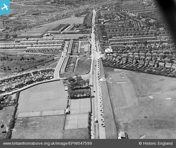
epw047599 ENGLAND (1935). Watling Street, the Will Adams Memorial and environs, Gillingham, 1935
© Copyright OpenStreetMap contributors and licensed by the OpenStreetMap Foundation. 2024. Cartography is licensed as CC BY-SA.
Details
| Title | [EPW047599] Watling Street, the Will Adams Memorial and environs, Gillingham, 1935 |
| Reference | EPW047599 |
| Date | June-1935 |
| Link | |
| Place name | GILLINGHAM |
| Parish | |
| District | |
| Country | ENGLAND |
| Easting / Northing | 578340, 166767 |
| Longitude / Latitude | 0.56249948087241, 51.37141529556 |
| National Grid Reference | TQ783668 |
Pins
 Ian |
Monday 8th of July 2013 02:39:03 PM | |
 Ian |
Monday 8th of July 2013 02:37:56 PM | |
 Ian |
Monday 8th of July 2013 02:36:40 PM | |
 Ian |
Monday 8th of July 2013 02:35:58 PM | |
 Ian |
Monday 8th of July 2013 02:35:23 PM | |
 Ian |
Monday 8th of July 2013 02:34:48 PM | |
 Ian |
Monday 8th of July 2013 02:26:20 PM |


![[EPW047599] Watling Street, the Will Adams Memorial and environs, Gillingham, 1935](http://britainfromabove.org.uk/sites/all/libraries/aerofilms-images/public/100x100/EPW/047/EPW047599.jpg)
![[EPW047598] Watling Street, the now Star Meadow Sports Club tennis courts and environs, Gillingham, from the east, 1935](http://britainfromabove.org.uk/sites/all/libraries/aerofilms-images/public/100x100/EPW/047/EPW047598.jpg)