
Scheduled Maintenance
This website will undergo scheduled maintenance on Tuesday, September 10th, between 11:00 and 15:00, as well as on Thursday, September 12th, between 10:00 and 12:00. During this time, services may be temporarily disrupted. We apologise for any inconvenience.
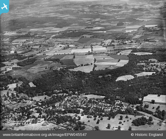
epw045547 ENGLAND (1934). Park Wood, Hoblingwell Wood and environs, Scadbury Park, from the south-west, 1934
© Copyright OpenStreetMap contributors and licensed by the OpenStreetMap Foundation. 2024. Cartography is licensed as CC BY-SA.
Nearby Images (3)
EPW045547

EPW045548

EPW045549

Details
| Title | [EPW045547] Park Wood, Hoblingwell Wood and environs, Scadbury Park, from the south-west, 1934 |
| Reference | EPW045547 |
| Date | July-1934 |
| Link | |
| Place name | SCADBURY PARK |
| Parish | |
| District | |
| Country | ENGLAND |
| Easting / Northing | 544891, 169628 |
| Longitude / Latitude | 0.08343182526615, 51.406649106164 |
| National Grid Reference | TQ449696 |
Pins
 Gone2Kent |
Wednesday 1st of January 2014 02:55:15 PM |