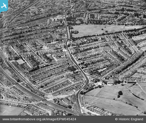
epw045424 ENGLAND (1934). Streatham High Road and environs, Streatham, from the south-east, 1934
© Copyright OpenStreetMap contributors and licensed by the OpenStreetMap Foundation. 2024. Cartography is licensed as CC BY-SA.
Details
| Title | [EPW045424] Streatham High Road and environs, Streatham, from the south-east, 1934 |
| Reference | EPW045424 |
| Date | July-1934 |
| Link | |
| Place name | STREATHAM |
| Parish | |
| District | |
| Country | ENGLAND |
| Easting / Northing | 530484, 170113 |
| Longitude / Latitude | -0.12342634292865, 51.414506763631 |
| National Grid Reference | TQ305701 |
Pins
 John Wass |
Tuesday 14th of April 2015 08:31:16 PM | |
 Rob |
Sunday 16th of November 2014 08:40:38 PM | |
 Rob |
Sunday 16th of November 2014 08:39:19 PM | |
 Rob |
Sunday 16th of November 2014 08:37:32 PM | |
 Rob |
Sunday 16th of November 2014 08:33:29 PM | |
 Rob |
Sunday 16th of November 2014 08:27:32 PM | |
 Class31 |
Wednesday 22nd of May 2013 09:09:53 PM | |
 Class31 |
Wednesday 22nd of May 2013 09:08:34 PM | |
 Class31 |
Wednesday 22nd of May 2013 09:07:50 PM | |
 Class31 |
Wednesday 22nd of May 2013 09:07:01 PM | |
 Class31 |
Wednesday 22nd of May 2013 09:06:17 PM | |
 Class31 |
Wednesday 22nd of May 2013 09:05:47 PM | |
 Class31 |
Wednesday 22nd of May 2013 09:05:06 PM |

